Cold and below normal temps start the new week
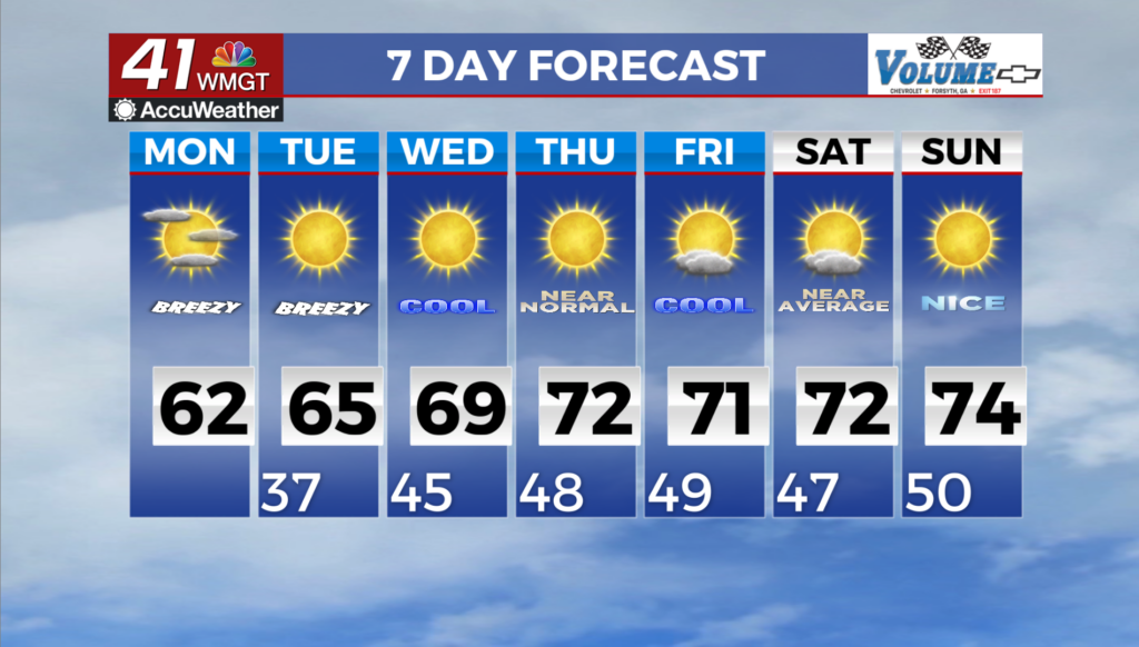
MACON, Georgia (41NBC/WMGT) – The dry, cool weather will persist through the short term period, although today marks the beginning of a gradual warming trend that will last through 


the week ahead. Surface high pressure will be centered over the Ohio Valley through Tuesday. With calm winds overnight, temperatures will again drop near or below freezing for a good bit of North and West Georgia and mid 30s elsewhere. High temperatures Monday will rebound into the low 60s areawide as expanded ridging moves east across the Plains. Another chilly night can be expected Monday night into Tuesday morning, although temperatures will creep up a couple of degrees. Through the middle of the upcoming week, the longwave trough that provided a chilly 


weekend will finally get kicked off to the northeast as a shortwave slides from the Southern Plains into the Eastern Gulf. This wave will not have much moisture or punch to it as it slides through the area, so rain chances will be very low and only across South Middle Georgia. The cool airmass from the weekend will finally be shoved out, allowing highs to climb back into the 60s on Tuesday and Wednesday, with overnight lows returning to above freezing. Behind the system, a ridge builds from the Gulf up across the Southeast U.S. during the second half of the week and into next weekend. Our stretch of dry weather continues in this setup, as temperatures warm back up into the 70s for Friday and next weekend, with overnight lows in the 40s to near 50.