

Cloudy weekend on deck for Middle Georgia
MACON, Georgia (41NBC/WMGT) – Cloud cover will linger this weekend even once rain from the system slows.
This Evening
Light rain has been ongoing for much of Middle Georgia throughout the lunchtime/afternoon hours. Heavier rain is creeping in from the southwest, however, and will continue to push north this evening and tonight. It is first Friday in Macon, so anyone going out later will need rain gear. The wind, luckily, has not been very strong. Gusts could reach as high as 15 mph from the northeast through this evening and tonight. It will be a cooler tonight with lows dropping into the mid 60s.
Tomorrow
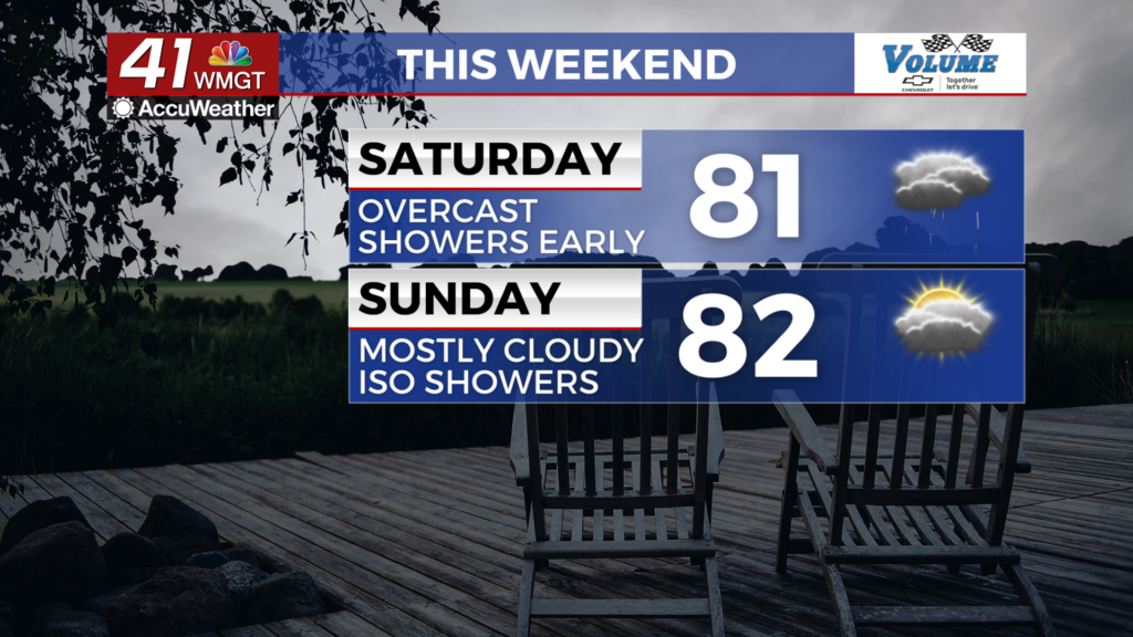
Saturday will begin with lingering showers (and perhaps a thunderstorm or two) as the low pressure system finally clears the region. While the rain should clear in the lunchtime hours, some showers may linger beyond that, and the cloud cover will not budge. Highs will be in the upper 70s and lower 80s with wind expected to be light and variable.


Overnight will also be overcast, however rain is not expected. Light and variable wind will continue as temperatures drop into the low to mid 60s.
Sunday
Sunday will be mostly cloudy with a few showers possible in the afternoon. Highs will reach the lower 80s for most of the region with wind expected out of the east at 5-10 mph. Overnight will be mostly cloudy with lows in the mid to upper 60s ahead of Monday morning.
The Tropics
We are down to two areas of interest in the Atlantic Basin. Area A has the greatest chance to develop, but at this time poses no threat to the Peach State. Area B is further east in the Atlantic and will require monitoring going forward.

Follow Meteorologist Aaron Lowery on Facebook (Aaron Lowery 41NBC) and Twitter (@ALowWX) for weather updates throughout the day. Also, you can watch his forecasts Monday through Friday on 41NBC News at 4, 5, 5:30, 6, and 11 p.m.