Clouds, rain, and cooler temperatures set the tone for the first week of October
MACON, Georgia. (41NBC/WMGT) – An incoming cold front will bring rain and cooler temperatures to Middle Georgia.
Today


Cloud cover and rainy weather began to move into Georgia over the weekend. That was only the beginning. Plenty of rain is expected around the Peach State this week, and an incoming cold front is our first weathermaker. For today, the abundance of cloud cover will continue as temperatures top off in the upper 70s and lower 80s. A couple of locations further east in Middle GA will see temperatures rise into the mid 80s, and those locations likely won’t deal with as much rain until later this week. Isolated showers will begin during the early afternoon hours and pick up in intensity later this afternoon. Some rumbles of thunder are likely as well. The rain will carry into the overnight hours as temperatures drop into the upper 60s.
As for the cold front, it will not arrive today. Overnight some showers and storms will move into the western counties of Middle Georgia ahead of the front. This will quickly turn into heavy rain ahead of the sunrise on Tuesday morning, particularly impacting the western counties such as Taylor and Crawford.
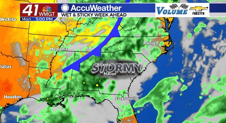
Tomorrow


Tomorrow begins with the cold front. As mentioned above, it will bring heavy rain and thunder into the western counties of Middle GA ahead of the sunrise. Then it will stall out, likely bringing the rain as far east as Macon and Warner Robins. This doesn’t mean that the heavy rain will not make it further east to locations such as Dublin; it’ll just arrive a bit later. The heavy rain is also not likely to be as widespread in the eastern counties of the region because of where the cold front stalls out. This will also impact temperatures for the afternoon, creating a much larger range than typical. High temperatures in the western counties tomorrow will be in the lower 70s while the eastern counties will still be climbing into the lower to mid 80s. Cloudy skies will persist across the region regardless of where the cold front ends up stalling out. Overnight a few showers will linger as temperatures fall into the upper 60s.
Wednesday and Beyond

Unlike after the last cold front where we were left with fall like conditions and clear skies in its wake, the conditions behind this next one are not so pretty. A low pressure system will move north from the Gulf of Mexico into the Southeastern US, bringing plenty of tropical moisture with it. A warm front will slowly move through Alabama and Georgia, bringing plenty of humidity, cloud cover, and rain as it progresses northward. This will bring widespread rainfall to Middle GA throughout the middle of the week as temperatures slowly warm back up into those upper 70s and lower 80s again. This pattern will likely carry into early Friday before clouds break Friday afternoon and some sunshine returns this weekend. Rain chances, however, will remain possible into the weekend.

Follow Meteorologist Aaron Lowery on Facebook (Aaron Lowery 41NBC) and Twitter (@ALowWX) for weather updates throughout the day. Also, you can watch his forecasts Monday through Friday on 41NBC News at Daybreak (6-7 a.m.) and 41Today (11 a.m).


Leave a Reply