
Clouds begin to move in tomorrow as temperatures begin to climb
MACON, Georgia (41NBC/WMGT) – Winds will begin to shift towards the south after tonight, leading to warmer temperatures, more humidity, and more cloud cover.
The Rest of the Evening
Skies will remain mostly sunny as the sun sets, however some scattered upper level clouds are likely overnight tonight. It will be a cold one again with temperatures dropping to around or just below freezing (the added clouds will do little to act as a blanket as they are too thin and high up). Wind will not be bad either as it comes from the east at around 5 mph.
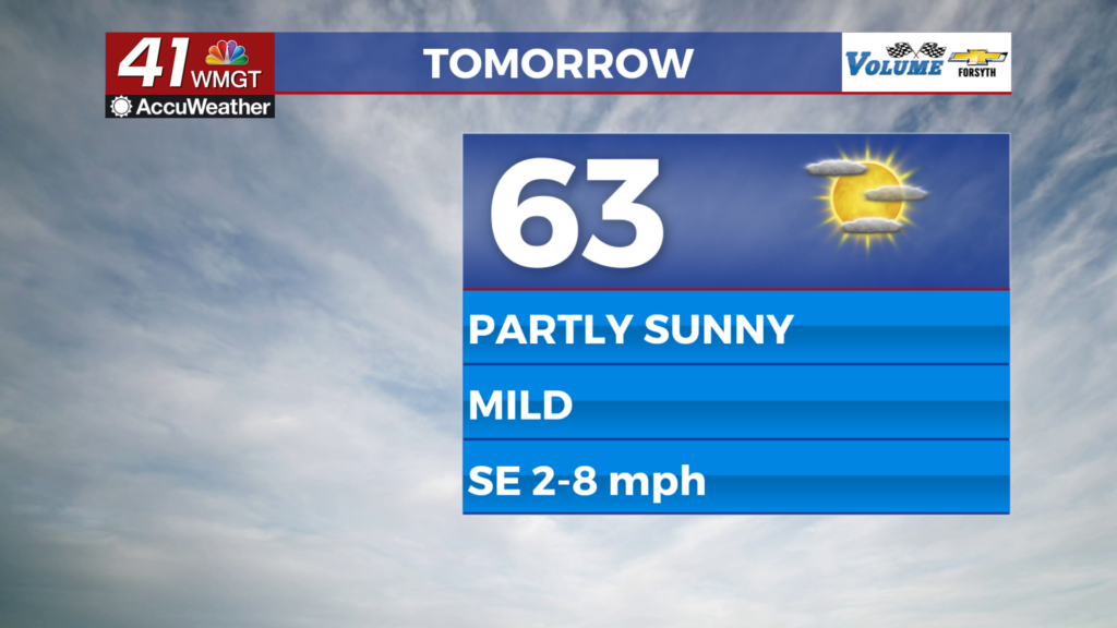
Tomorrow
Partly sunny skies are likely Thursday afternoon with all cloud cover falling into the upper level category. This will let some sun through, however a number of these cirrus clouds are expected to hang over the Peach State. Temperatures will reach into the low to mid 60s with wind from the southeast at around 5 mph.


Tomorrow night some mid level clouds will begin to enter the picture, allowing for warmer conditions ahead of Friday morning. Still, it will be cold with lows into the upper 30s and lower 40s. Wind will come from the south-southeast at around 5 mph.
Friday and Beyond
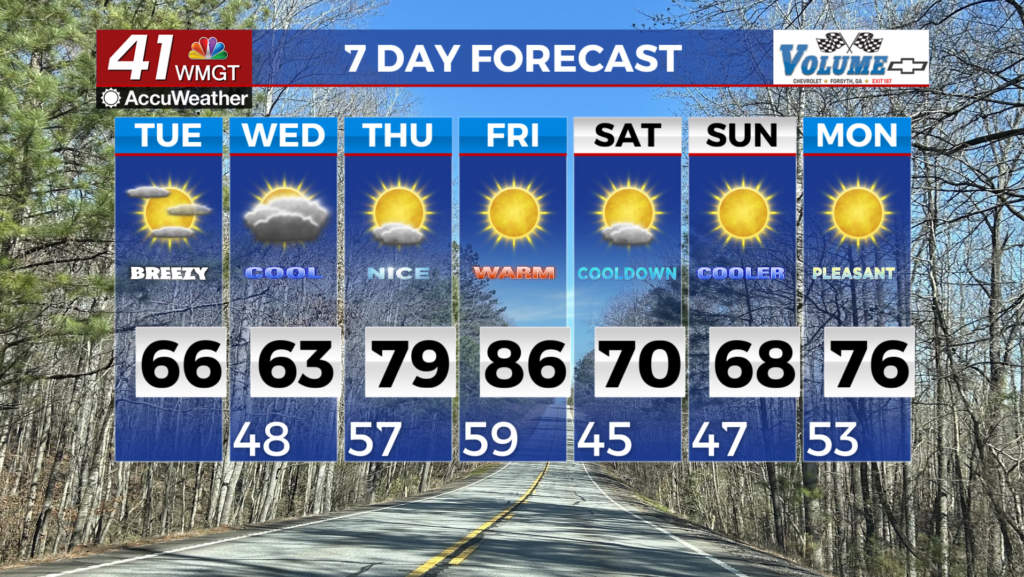
Partly to mostly cloudy skies are likely Friday afternoon with temperatures reaching into the upper 60s and lower 70s. Winds from the south-southwest will range from 5-10 mph, gusting to about 15. Cloud cover will linger overnight and into Saturday when showers first begin to enter the fray. Saturday should also see highs into the lower 70s for most of the region with the wind remaining out of the south-southwest. Speeds by Saturday afternoon should range from 5-15 mph, gusting upwards of 20-25 mph.
Widespread rain looks to move in Sunday and stick around through the day and into the overnight hours. Monday will see thunderstorms as the slow moving cold front finally pushes through. It is too far out at this time to know about severe potential.

Follow Meteorologist Aaron Lowery on Facebook (Aaron Lowery 41NBC) and Twitter (@ALowWX) for weather updates throughout the day. Also, you can watch his forecasts Monday through Friday on 41NBC News at 4, 5, 5:30, 6, and 11 p.m.