


Clouds and widespread storms expected later today
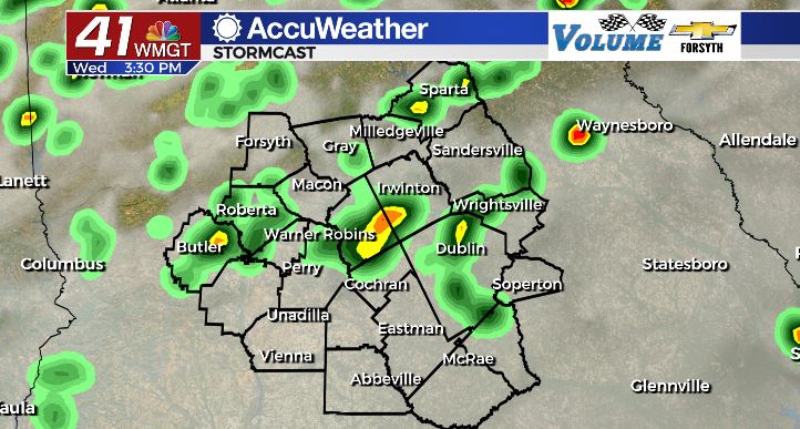
MACON, Georgia. (41NBC/WMGT)- Scattered storms are likely across the majority of Middle Georgia this afternoon
Today
Another pattern change has arrived in the Peach State as low pressure makes its way into Georgia. Today kicked off with mostly cloudy skies around the region, setting the stage for a potentially rainy afternoon as things heat up. We will see a bit of sunshine poking through early, however once the lunchtime hours arrive storms will begin. Temperatures this afternoon will be cooler than the past couple of days thanks to the abundance of cloud cover, topping off in the mid 80s. The expected rainfall will also keep things a little cooler. Most of Middle Georgia will see somewhere between 1/3 of an inch and 1/2 of an inch of rain over the next 24 hours. For tonight, expect cloudy skies to hang around while temperatures fall into the lower 70s. A few storms are anticipated overnight and could carry into the morning.
Tomorrow
Many parts of Middle Georgia will likely wake up to some rainfall that begins in the early morning hours. As the low pressure continues to push southeastward, the northern half of the region should see the rain subside before lunchtime. The southern half, however, will likely see it continue into the later afternoon hours. Widespread scattered storms are also likely during the afternoon hours of Thursday. High temperatures will top off in the mid to upper 80s thanks to a bit more sunshine. As the evening progresses pop up storms should subside and clouds should begin to clear a bit. The low pressure will make its way into the Atlantic to clear things out a bit heading into Friday. High pressure will be making its way into the Southeastern US at the same time. Low temperatures tomorrow night will be in the mid 60s.
Friday and this Weekend
Friday will likely begin on a partly cloudy note, with high clouds expected to hang around Middle Georgia throughout the day. Plenty of sunshine will get through these, warming things up into the upper 80s around the region. A couple of select locations might reach the 90 degree mark during the afternoon hours. Rain chances will be down significantly with the low pressure out of the picture, but an isolated storm or two cannot be ruled out. If there are any storms, they should clear out during the early overnight hours ahead of Saturday. Cloud cover will also break during this time, including the higher level clouds still associated with the low. Temperatures will also fall into the low to mid 60s.
Saturday expect an abundance of sunshine as temperatures climb into the lower 90s around Middle Georgia. Again, an isolated shower or storm will remain possible in the afternoon, but it will be great weather to get outside. Humidity is expected to be a bit lower than what we have seen this week thanks to high pressure taking over the area. Any outdoor plans should be a go, but do remember to wear plenty of sunblock and reapply it often as UV indices climb back above 8.
Sunday looks to be almost a carbon copy of Saturday, with high temperatures in the lower 90s and low temperatures in the mid to upper 60s.

Follow Meteorologist Aaron Lowery on Facebook (Aaron Lowery 41NBC) and Twitter (@ALowWX) for weather updates throughout the day. Also, you can watch his forecasts Monday t hrough Friday on 41NBC News at Daybreak (6-7 a.m.) and 41Today (11 a.m).


Leave a Reply