

Cloud cover increases Wednesday
MACON, Georgia (41NBC/WMGT) – Temperatures and cloud cover will increase around the Peach State Wednesday.
This Evening
Conditions have warmed nicely from Monday afternoon as 24 hour temperature jumps have hovered around 15 degrees. The wind has been light from the south. That will remain the case tonight as skies will stay mostly clear through much of the night. High clouds will begin to arrive ahead of the sunrise tomorrow, accompanied by temperatures just below freezing.
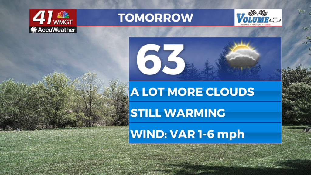
Tomorrow
A mostly cloudy day is likely as a blanket of cirrus clouds will hang overhead throughout the entire day. Some sun will get through, however, so it won’t feel gloomy outdoors. Temperatures will climb into the low-mid 60s for much of the region and the wind will be light and variable.


Overnight will stay cloudy with the possibility for a shower or two before sunrise Thursday morning. Overnight lows will largely be in the lower 40s across Middle Georgia. Wind will flow from the east-southeast at around 3 mph.
Thursday and Beyond
Thursday will be the warmest day of the week as temperatures reach the upper 60s with a few lower 70s possible. Cloud cover will be dominant, however, and off and on showers or a few storms will be possible throughout the day. More rain is likely overnight as a cold front will make its passage ahead of Friday morning. This will lead to a cooler end to the week with plenty of wind but also the return of sunny skies.

Follow Chief Meteorologist Aaron Lowery on Facebook (Aaron Lowery 41NBC) and X (@ALowWX) for weather updates throughout the day. Also, you can watch his forecasts Monday through Friday on 41NBC News at 4, 5, 5:30, 6, and 11 p.m.