


Bitter temperatures return overnight
MACON, Georgia (41NBC/WMGT) – Temperatures will drop well below freezing overnight tonight before a warming trend takes over the next few days.
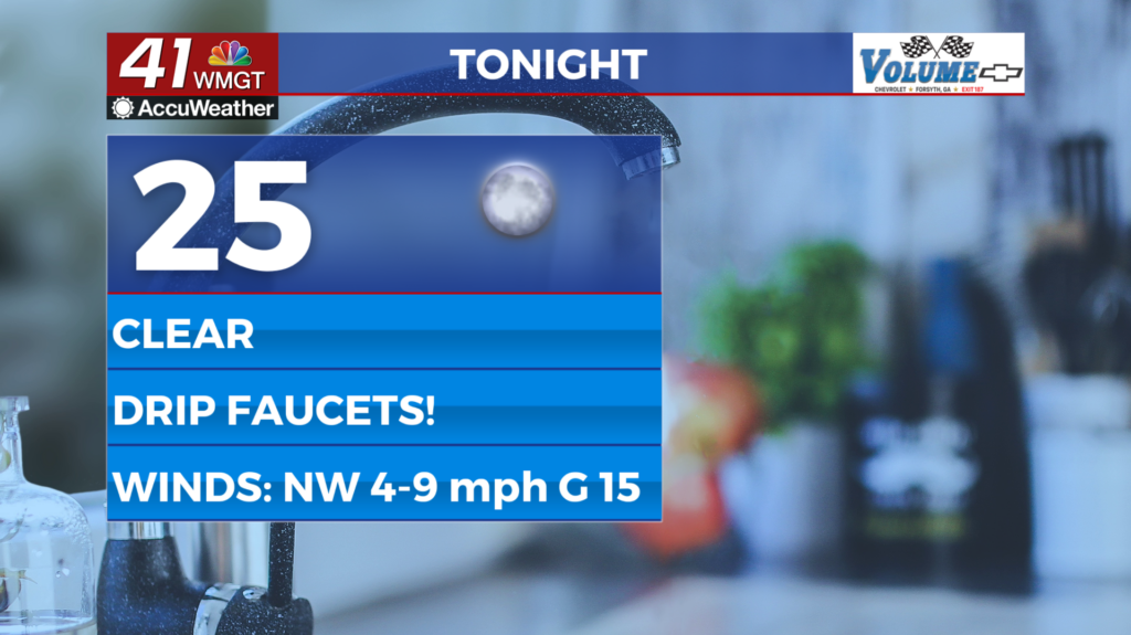
This Evening
A sunny and blustery afternoon will give way to a clear and bitter night around Middle Georgia. Temperatures should be approaching freezing by midnight with lows likely in the mid 20s for most of the region. Wind chills could be into the lower 20s as gusts of 15 mph will remain possible from the northwest overnight. It is suggested that Middle Georgians let the faucets drip to avoid plumbing issues. Also bring in any outdoor pets and small plants!
Tomorrow
Another sunny day is expected and temperatures will be more comparable to Sunday vs Monday of the new week. It should feel nicer than Sunday however as the wind will shift from the northwest to the southwest throughout the afternoon. Expect that wind to be light; a nice change of pace from Sunday and Monday.


Overnight cloud cover is expected to increase around the region. Wind will flow from the southwest at 5-10 mph with gusts to around 15 mph. Some fog will be possible by Wednesday morning, however no rain is expected. Temperatures will still be chilly as some spots could get down to freezing ahead of the sunrise once again.
Wednesday and Beyond
Cloud cover will be a lot more dominant Wednesday and Thursday. Despite this temperatures will climb into the upper 60s/lower 70s on Wednesday with almost every part of the region reaching the 70s on Thursday. Expect both of those days to have solid wind from the southwest as moisture returns to the atmosphere before the next round of rain Thursday night with the arrival of the next cold front. Sunshine should return on Friday.

Follow Chief Meteorologist Aaron Lowery on Facebook (Aaron Lowery 41NBC) and X (@ALowWX) for weather updates throughout the day. Also, you can watch his forecasts Monday through Friday on 41NBC News at 4, 5, 5:30, 6, and 11 p.m.