Big time heat continues despite increased rain odds.
MACON, Georgia (41NBC/WMGT) – Scattered storms will remain possible tomorrow, however the Heat Advisory remains in effect across Middle Georgia.
This Evening


While it was a cloudy start to our Wednesday plenty of sun has emerged this afternoon making things quite hot and sticky. The Heat Advisory across Middle Georgia has again been extended, this time through 8 PM EDT tomorrow evening.


As for storm chances, they have not come to fruition as expected thus far today. Still, isolated to scattered activity remains possible tomorrow through the evening and overnight. No severe weather is expected, however. Overnight lows will be in the mid 70s under partly cloudy skies, and wind will be light from the south-southwest.
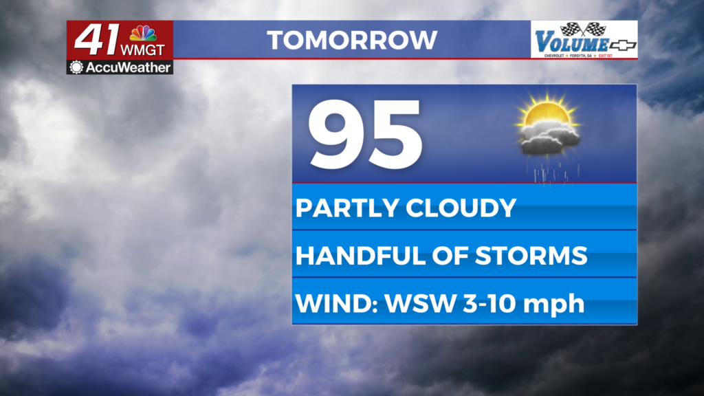
Tomorrow


Another hot and humid afternoon is likely around Middle Georgia as highs climb into the mid to upper 90s under partly cloudy skies. Heat indexes should reach over 105 for much of the region again, hence the extension of the Heat Advisory mentioned above. There will be more clouds in the afternoon as storm chances increase with close to half the region anticipated to receive rain through the afternoon and evening.


Overnight will feature scattered clouds overhead and lows again largely in the mid 70s. Wind will be light out of the west-southwest, and fog will be possible ahead of sunrise Friday.
Friday and Beyond


Friday will again be partly cloudy with highs in the mid to upper 90s. The Heat Advisory could possibly be extended to include Friday, however at this time it does not. Scattered storms will again be likely over the latter half of the day.

Over the weekend cloud cover will be dominant and an incoming cold front should drop temperatures into the 80s, especially Sunday. Widespread storms are expected Saturday with Sunday dropping closer to 50% odds (half the region). The cloudy and wet pattern should carry into the start of next week.

Follow Chief Meteorologist Aaron Lowery on Facebook (Aaron Lowery 41NBC) and Twitter (@ALowWX) for weather updates throughout the day. Also, you can watch his forecasts Monday through Friday on 41NBC News at 4, 5, 5:30, 6, and 11 p.m.