
Arctic air arrives in Middle Georgia
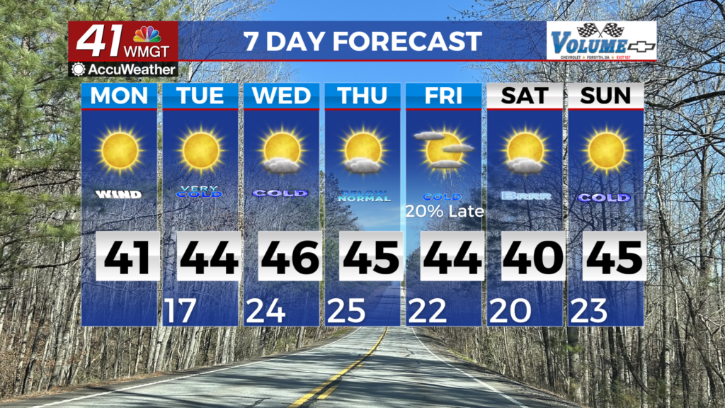
MACON, Georgia (41NBC/WMGT) – Temperatures have steadily fallen behind the front as conditions have slowly improved. Patchy fog has moved out behind the line of showers. Any wet 


roads overnight should begin to dry. Winds begin to pick up with wind gusts up to 30 mph. Areas to the extreme far north which saw significant ice accumulations may remain below freezing tonight. The combination of ice and winds will lead to an increased risk of falling tree limbs and damage to powerlines. Remain vigilant through tomorrow morning. Life-threatening cold remains the big story Tuesday morning, as low temps will be in the single digits to low teens across North Georgia, and mid to upper teens in Middle Georgia. The winds will make feels-like temperatures fall to the low single digits! The bottom line is these temperatures are hazardous for anyone exposed to the elements. Another concern in these cold temperatures is the increased risk for burst pipes. Temperatures will only climb to the mid to upper 30s in North Georgia, and low to mid 40s in Middle Georgia. The cold weather continues from midweek into the weekend as troughing and an Arctic airmass remain stretched across most of the Eastern U.S. On Wednesday, a weak shortwave and associated dry cold front slides across the Southeast U.S. reinforcing the cool airmass after high temperatures finally reach into the 40s across much of the area. Breezy winds will also move in behind the front, increasing the potential for hazardous temperatures. Without factoring in the wind, low temperatures for Thursday through Saturday will likely be in the teens to 20s with highs temps in the 30s. Hello Winter!