Another frigid night expected; warming continues Friday
MACON, Georgia (41NBC/WMGT) – Temperatures will climb into the upper 40s Friday afternoon as snow continues to melt.
This Evening


High cirrus clouds have been present across Middle Georgia this afternoon and will remain overhead through this evening and tonight. It will be a slightly warmer night than the last two, however it will still be well below the average for this time of year. Expect temperatures to go sub-freezing by the end of the suppertime hours with overall lows expected in the low to mid 20s. Dripping the faucets overnight is again suggested to avoid plumbing issues. Wind will flow from the northwest at around 5 mph.
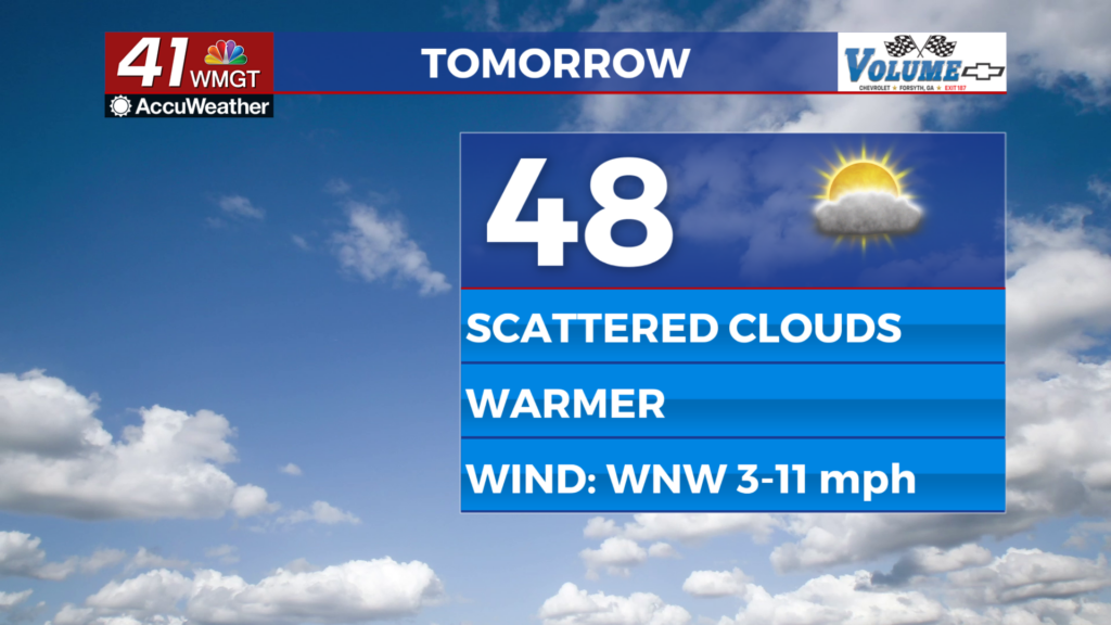
Tomorrow


Friday will be the warmest day of the week as highs climb into the mid to upper 40s across the region. One or two spots may reach 50. Wind will flow from the west-northwest at 5-12 mph, gusting upwards of 20 mph. Snow will continue to melt as skies overhead will feature scattered cumulus clouds to go with the warmer conditions.


Overnight skies will be clear as temperatures again plunge into the lower 20s for most of the region. This could lead to re-freezing on any roads still wet from Tuesday’s snow. Wind will calm and become variable in direction by Saturday morning.

Follow Chief Meteorologist Aaron Lowery on Facebook (Aaron Lowery 41NBC) and Twitter (@ALowWX) for weather updates throughout the day. Also, you can watch his forecasts Monday through Friday on 41NBC News at 4, 5, 5:30, 6, and 11 p.m.


