

Another dry day before humidity returns
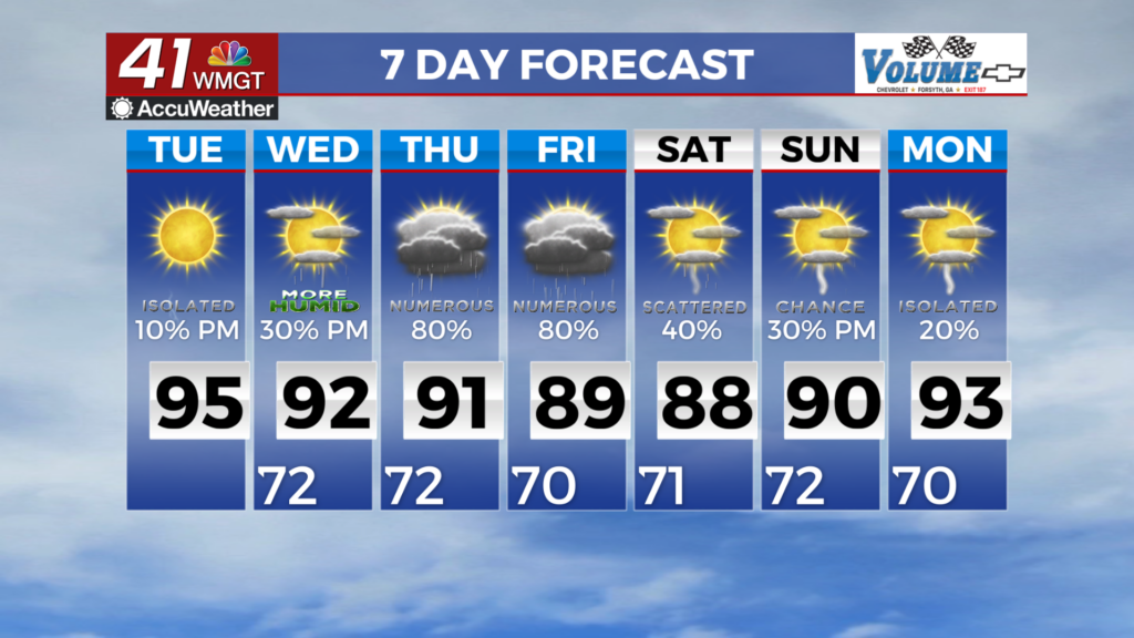
MACON, Georgia (41NBC/WMGT) – Calm weather is expected for one more day. Dry conditions behind a cold front will limit our thunderstorm chances to a minimal, and contained to the 


southern potions of the coverage area. Winds will be out of the northwest at 5 to 10 mph. Drier weather will expand further with relative humidity values dropping by afternoon to the 40% range. Light and variable winds are expected overnight. Model guidance is generally in good agreement regarding the upper-level pattern midweek through the weekend. Troughing over the Southeast for 


the first half or so of the long term period will transition to ridging on Saturday. Under the influence of the trough, daily chance to likely possibility of precipitation will prevail. Disturbances within the trough may enhance convection each day and lead to the potential for growth. Moisture is forecasted to remain plentiful this weekend, although the transition to upper-level ridging and therefore less lift may hamper convection somewhat. The moisture will make the high temperature in the lower to middle 90s feel like 100 to 105 degrees across Middle Georgia and parts of North Georgia each day. The coverage of heat index values of 105 degrees or greater will determine if and when and where Heat Advisories are issued.