
Another cool day before heat surges back to Middle Georgia
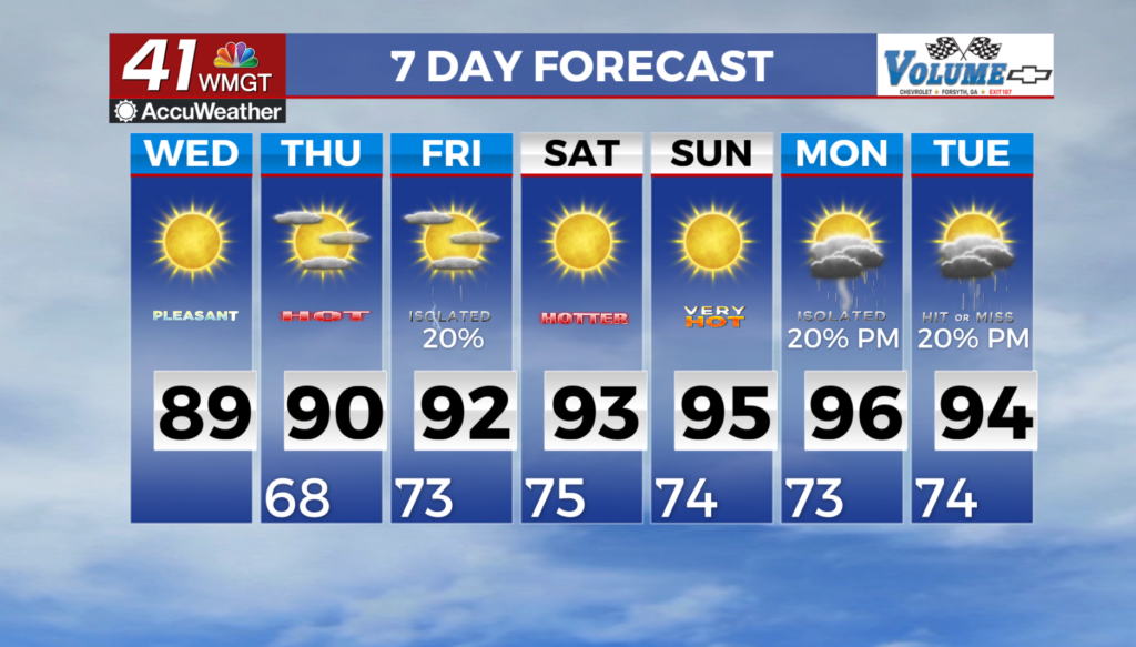
MACON, Georgia (41NBC/WMGT) – Dry and temperate conditions prevail through Thursday, bringing a nice break to the recent humid and summery weather. In the wake of the cold front that has cleared the area to the south, considerably lower dewpoints and temperatures continue to move into the area. Breezy conditions have settled, leading to pleasant Wednesday morning temps 


by late June standards. Low temperatures are some 8 to 12 degrees below normal and will range from the upper 50s in parts of north Georgia to mid 60s farther south with a few low to mid 50s even sprinkled in across the north Georgia mountains. Northwest flow is expected to bring continued dry conditions with any southeastward storms favored to remain displaced to our west across Mississippi and Alabama from Wednesday into Wednesday night. High on Wednesday will largely be near to slightly below normal in the mid to upper 80s, and drier dewpoints in the upper 50s 


to low 60s will bring a more pleasant feel. By Thursday, we return to more of a typical summertime weather pattern. Weak mid-level flow and increasing southerly flow at the surface brings an influx of moisture back to the area. Isolated to widely scattered showers and thunderstorms will be possible mainly across Middle Georgia during the afternoon with temperatures climbing into the upper 80s across North Georgia, and low 90s across Middle Georgia. Friday will favor similar conditions although rain and thunder chances will be a tad higher as will temperatures. Convection may be more limited on Saturday and Sunday as a weak disturbance transverses across the southern Ohio Valley and midlevel ridging starts to build from the west. The main story for the extended forecast period, specifically this weekend through early next week, will be the heat. Latest models are painting mid to upper level ridging becomes highly amplified and encompassing much of the eastern U.S. between Sunday and Monday. As a result, high and low temperatures are forecast to climb a degree or two each day through early next week. Forecast highs between Saturday and Monday are anticipated to be in the 90s areawide. Heat indices will follow suit with values in the upper 90s to low 100s during the same period. Be sure to take precautions if spending any amount of time outdoors.

