


Another breezy and cool start to the week
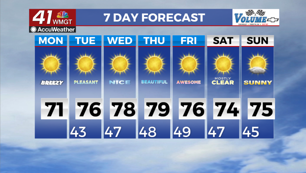
MACON, Georgia (41NBC/WMGT) – We will have a couple of days left of the cool temperatures. Dry air will hold, allowing overnight temps to dip into the 40s and 50s the next few nights. The 


mountains of North Georgia may see some patchy frost this morning, however this is unlikely to be widespread. Just make sure you keep an eye on low lying areas which are protected from morning sunlight if you have sensitive vegetation. Winds will remain at 5 to 10 mph out of the northeast today. This should taper off as we get into the evening as the low off the East Coast moves further away. High temperatures will climb each day through mid-week as the reinforced northwest flow weakens. Expect to see mid to upper 70s by Wednesday. No precipitation is expected. For the middle and late parts of the week, Georgia will remain positioned between a vertically stacked low pressure system meandering along the Mid-Atlantic and New England coasts and an 
intensifying upper level ridge over the Great Plains. Northwesterly flow aloft will persist between these features while a broad surface high will be centered over the eastern U.S. and southeast Canada. This high pressure regime will contribute to rain chances of near zero percent through the end of the week and into the weekend. Plenty of sunshine under the high will also lead to gradually warming temperatures. High temperatures on Wednesday will be in the mid to upper 70s on Wednesday afternoon, with some low 80s creeping into Middle Georgia on Thursday and Friday. Strong radiational cooling with mostly clear skies and fairly light winds will keep temperatures brisk during the overnight hours, with lows in the mid 40s to near 50 each morning. By the weekend, the axis of the upper ridge will slide further east, becoming centered closer to the forecast area and bringing a reinforcing shot of drier air to the area. The surface high will strengthen and move east of the Appalachians. At this point, a wedge of high pressure will spread into North Georgia, leading to breezy easterly winds and relatively cooler temperatures on Saturday. The lack of rain plenty of sunshine will help dry out finer fuels, so the development of fire danger concerns will need to be monitored as the week goes on.