

Another breezy and chilly day for Middle Georgia
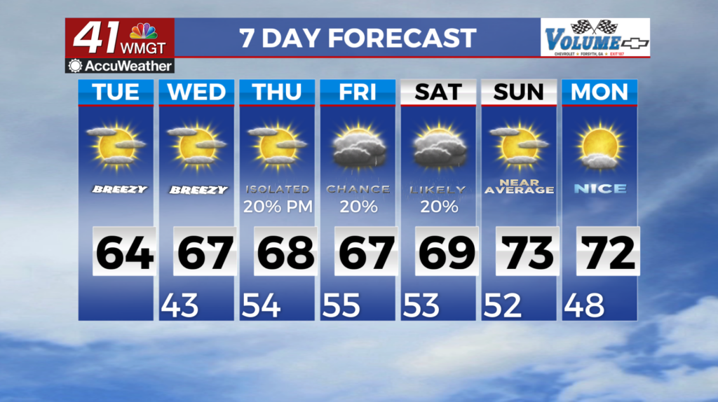
MACON, Georgia (41NBC/WMGT) – A building upper level ridge brings a slight warming to temperatures. Near surface flow will remain out of the east to northeast, thanks to the high over the 


Northeast U.S. No precipitation is expected across the greater coverage area, however portions of East Middle Georgia do see chances between 10 and 20 percent as the low moves east-northeast on Tuesday and Wednesday. Deepening troughing and a wave break brings uncertainty to the strength of the high through the latter half of the work week. Expect mostly clear and Fall-like conditions through the coming days. A notable shift in our models over the past 24 to 36 hours has increased uncertainty in the forecast for the second half of the week into the upcoming weekend. 


Previous guidance had a shortwave ejecting out of the Southern Plains across the northern Gulf and out into the Atlantic, with a strong ridge building across the Southeast in its wake. The latest shift has trended towards the shortwave cutting off from the flow over the northeast Gulf and strengthening into a closed low by late Wednesday into Thursday. From there, guidance has the low very slowly lifting across the Southeast through the weekend, potentially resulting in more unsettled weather than previously forecast. There are several sources of uncertainly with these cutoff low patterns, with the main one being how far north the associated moisture and precipitation can spread. The most recent trends suggest that this moisture spreads up across North and Middle Georgia late week and linger through the weekend, but there is one other player in this— the wedge. Surface high pressure over the Mid-Atlantic will send dry and stable low-level air across Georgia. This will do its best to fight any moisture pushing in from the low, which will be dependent on its track and strength. Bottomline, the evolving pattern warrants close watching given the substantial shift from the previous dry forecast conditions. In summary, factoring in the latest trends and uncertainty, North and Middle Georgia is likely to see a slight warming trend for the second half of the week into next weekend, with the potential for rain. Highs will likely climb back into the upper 60s to low 70sm with overnight lows in the upper 40s to low 50s.