
Afternoon showers & storms increase for Middle Georgia
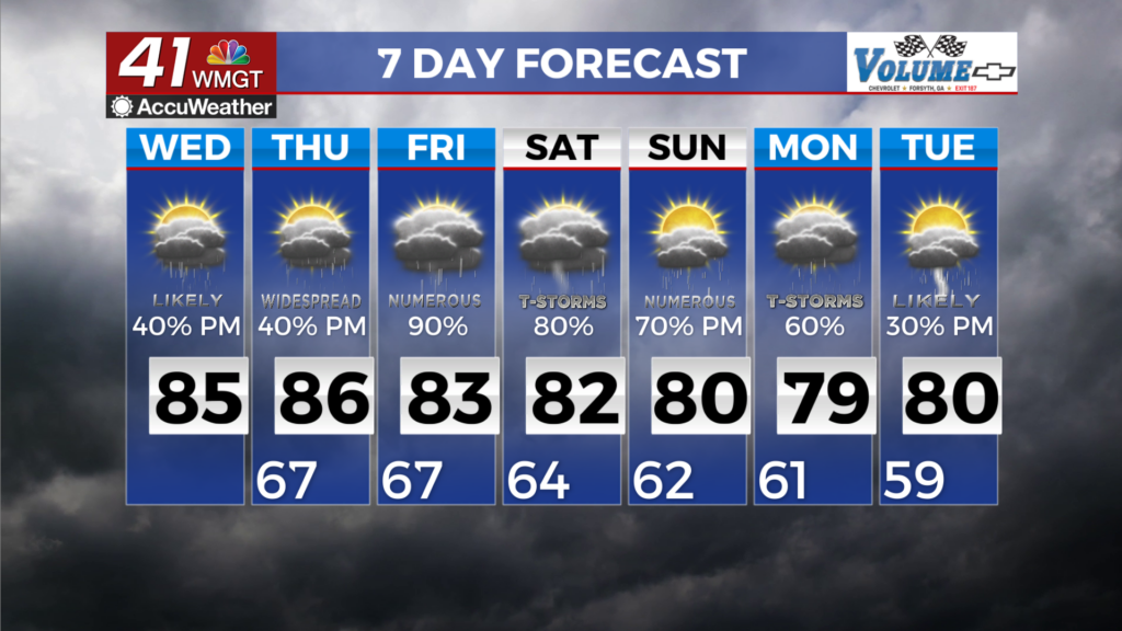
MACON, Georgia (41NBC/WMGT) – The forecast for Wednesday remains largely the same within the tropical environment — waves of showers and thunderstorms through the afternoon and 


evening, followed by cloudy, humid, and misty nights and mornings. Deep Gulf moisture continues to be funneled in. Any storms that do form will continue to be very efficient rainfall producers. Some locations have already picked up 5-6 inches or more of rainfall in the past couple of days, with minimal recovery time in between deluges. Localized flash flooding concerns will continue. Training storms, or storms that anchor to any lingering outflows or boundaries, could drop a quick 2 to 3 inches of rainfall or potentially more. A glance at the satellite shows weak organization 


of storms into clusters is possible along any remnant outflows or more indistinct surface boundaries. The strongest pulses will continue to have precipitation-loaded downdrafts capable of producing isolated damaging wind gusts, however the summer-like environment with unimpressive features will preclude severe concerns from becoming widespread or numerous. Any clustering of storms will locally bolster chances for damaging winds. Models are hinting at the center of our persistent ridging moving closer to the Georgia/Carolina coast over the next 24 hours with surface winds kicking more solidly southwest around the western edge of the ridge, and weak increases in subsidence (dryness) may result in slightly lower chances for convective activity on Wednesday afternoon. However, all other variables considered, Thursday should be another near-carbon copy of today.