

Above normal temperatures will stick around, as rain chances decrease
MACON, Georgia (41NBC/WMGT) – The latest satellite loop shows mostly clear skies across the region with a developing frontal boundary moving east out of the Plains and into the Upper to Mid Mississippi River Valley. There is also a weakening high pressure ridge centered over central Kentucky that is expected to move southeast off the North Carolina coast Thursday afternoon. 


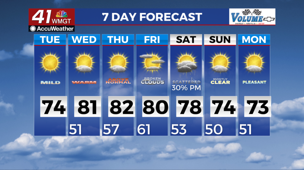
 This ridge will be nosed down across South Carolina/Georgia border through Tuesday evening as the frontal boundary pushes east mainly into the Great Lake states. The tail end of this boundary does push slightly into North Georgia Tuesday evening but the ridge keeps the deeper moisture and dynamics well north of the state. We could still see some light showers across North Georgia Tuesday night but we are not expecting any thunder. At most we could see a sprinkle across North Georgia Tuesday night. Low temperatures tonight will cool near seasonal norms with lows mainly in the 40s and some upper 30s in the North Georgia mountains. Temperatures will warm substantially Tuesday with highs in the 70s to near 80 across Middle Georgia. These temps will be about 5 to 10 degrees above normal for this time of the year. With the increased cloud cover Tuesday night, temps will only dip down into the 50s to upper 40s. The primary focus of the long term forecast remains focused on the next opportunity for widespread rain. After a system Tuesday night that looks like a dud for most of the state, the next opportunity for rain should arrive over the weekend.

