


A taste of summer is coming
MACON, Georgia (41NBC/WMGT) – Temperatures will surge across Middle Georgia starting Wednesday.
This Evening
Mostly sunny skies from the afternoon will see a few more high clouds move in during the evening and overnight. It will be a muggy night with lows largely expected in the lower 60s. Dew points will also be in the lower 60s. Accompanied by calm winds from the southeast (around 5 mph) the ingredients will be there for fog, especially ahead of Wednesday morning.
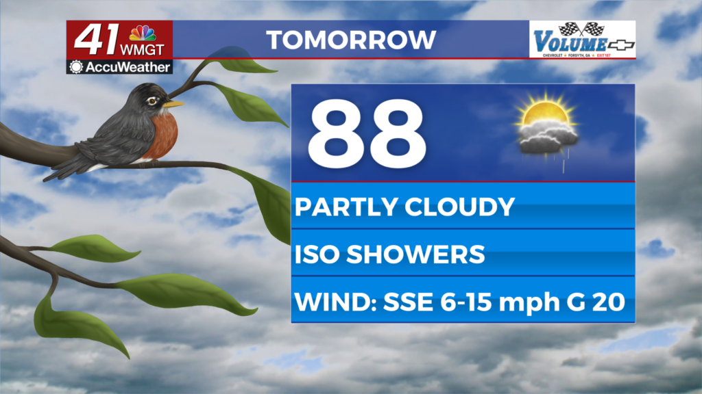
Tomorrow
A foggy morning will give way to partly cloudy skies in the afternoon. Highs will mainly reach the upper 80s, however the hottest spots could potentially reach 90. A few isolated showers and storms will be possible in the afternoon and evening, particularly in the eastern third of the region. Wind will be breezy from the south-southeast around 6-15 mph with gusts pushing 20 mph.


Expect the breezes to continue through tomorrow night as well. This will limit the fog possibilities, however it cannot 100% be ruled out. Lows will be in the mid to upper 60s across the region, or close to 20 degrees above the average for this time of year. A stray shower will also remain possible.
Thursday and Beyond
The heat will continue through the remainder of the week under partly sunny skies. It will also remain humid as dew points stay in the 60s. Rain odds will stay low, however a few stray showers or perhaps a thunderstorm will be possible in the afternoon. Some locations may see record highs fall ahead of the weekend. Expect mosquitos to emerge in the evening with conditions getting warm and muggy, especially after the rain to begin the week.

Follow Chief Meteorologist Aaron Lowery on Facebook (Aaron Lowery 41NBC) and Twitter (@ALowWX) for weather updates throughout the day. Also, you can watch his forecasts Monday through Friday on 41NBC News at 4, 5, 5:30, 6, and 11 p.m.
