
A new warming pattern begins Friday
MACON, Georgia (41NBC/WMGT) – Following a couple of cooler and dryer days the heat and humidity will start to climb again rolling into the weekend.
This Evening
A sunny and warm afternoon will become another clear and crisp night across Middle Georgia save for a few high clouds passing overhead leading into Friday morning. Temperatures will valley in the mid 50s across most of the region as the wind flows from the south-southeast around 5 mph.
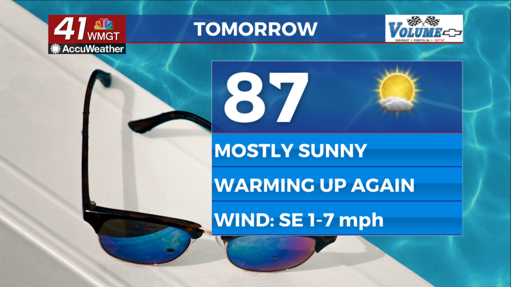
Tomorrow
It will be a mostly sunny end to the work week as temperatures rebound into the mid to upper 80s in the afternoon. The wind will flow from the southeast around 5 mph. Cloud cover should largely be limited to upper level cirrus passing overhead.


Overnight will feature more of those upper level clouds as conditions continue to gradually warm. Temperatures will bottom out in the upper 50s and lower 60s across the region leading into Saturday morning. The wind will remain light from the southeast around-southeast.
This Weekend and Beyond
Temperatures will continue to rise along with dew points through the weekend. Both days should be partly cloudy however Sunday will likely feature more clouds in the afternoon. The odds for rain over the weekend have largely dropped and there is a good chance Middle Georgia will see none at all. Isolated odds do look possible during the first few days of next week as temperatures climb into the lower 90s.

Follow Chief Meteorologist Aaron Lowery on Facebook (Aaron Lowery 41NBC) and X (@ALowWX) for weather updates throughout the day. Also, you can watch his forecasts Monday through Friday on 41NBC News at 4, 5, 5:30, 6, and 11 p.m.