


A lull followed by more storms
MACON, Georgia (41NBC/WMGT) – Most of the showers and thunderstorms have moved out of the area, as an unseasonable wedge has set itself up over northeast Georgia. This wedge 
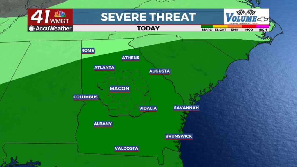
 is mixing with a stationary front that’s draped across the southeast. As a result, we have low clouds and misty conditions. The big question is whether or not the wedge will erode, and if it does will the warm sector expand northward. The warm sector (which is south from Columbus to Macon) should build some instability especially that some clouds are beginning to lift. Some thunderstorms are forming across western Alabama and they’re moving into an environment that’s beginning to see clouds breaks with daytime heating. North of I-20 is a completely different air mass. Low clouds continue to linger. Dewpoint values are in the 50s. Any storms that do make it into this area, are likely to encounter a hostile environment. So while a couple of rumbles of thunder are possible, our primary concern remains across the central and southern parts of Georgia. For tomorrow, the stationary front will continue to slowly sink southward setting up along and west of I-16 and be our source of lift again for what looks like a daytime heating thunderstorm event. While the likelihood of organized severe weather tomorrow appears low, any storms that form along the stationary front could have strong to severe winds.