A few strong to severe storms possible tonight
MACON, Georgia (41NBC/WMGT) – Severe weather is expected in parts of the Tennessee Valley this afternoon and the remnants of those storms may impact parts of Middle Georgia tonight.
This Evening and Overnight


It’s been a partly cloudy and hot day around Middle Georgia with most spots seeing heat indexes this afternoon over 100 degrees. A heat advisory is in effect and will remain in effect until 8 PM tomorrow evening. Rain activity has also been very limited. That should remain the case through most of this evening, however storms from Tennessee will enter into the Peach State ahead of 7 pm. They will continue southward as we go into tonight, possibly not arriving in Middle Georgia until close to midnight.


Most of the region is under a Level 1 “Marginal” risk, however the northeastern counties are under a Level 2 “Slight” risk. This is because some storms may cluster, bringing a greater threat for powerful straight line winds.


Aside from storms it will be mostly cloudy with temperatures staying in the low to mid 70s. Expect wind out of the west around 5 mph as well as some fog after any rain clears out.
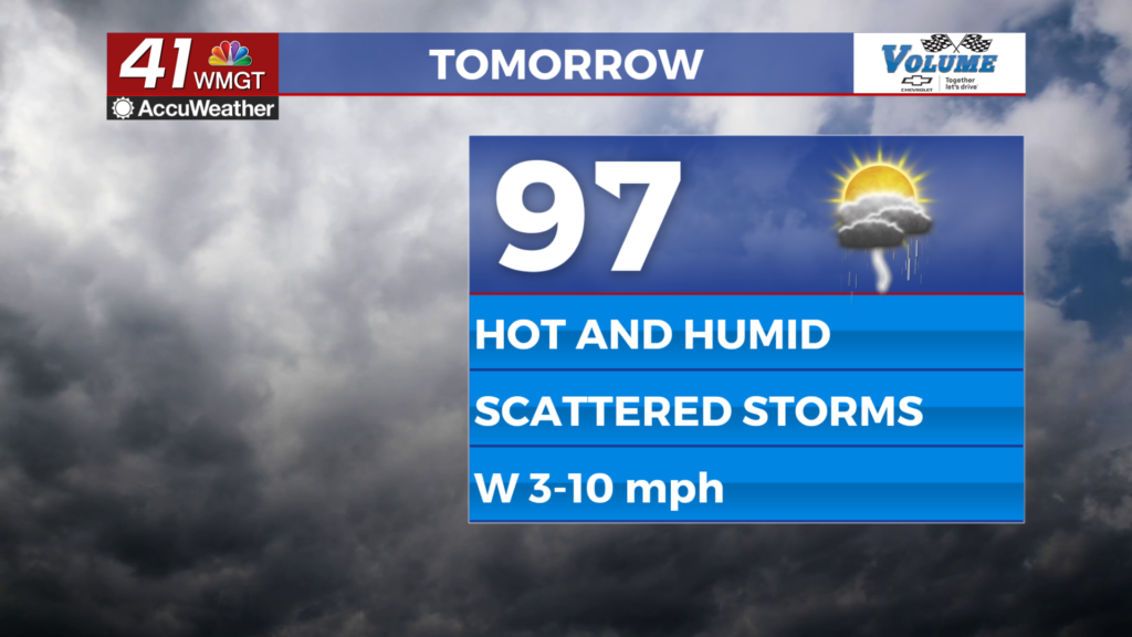
Tomorrow


Wednesday will be partly cloudy as well as hot and humid with highs reaching the upper 90s and heat indexes pushing towards the 110 degree mark. Isolated to scattered storms will be possible again, however they should be more of the typical pop up kind and less organized, thus no severe outlook has been issued for the region.


A few showers or storms may linger into tomorrow night before tapering off after midnight. A couple of showers may linger beyond that. Overnight lows will be in the low to mid 70s with ambient wind out of the west-southwest around 5 mph.

Follow Meteorologist Aaron Lowery on Facebook (Aaron Lowery 41NBC) and Twitter (@ALowWX) for weather updates throughout the day. Also, you can watch his forecasts Monday through Friday on 41NBC News at 4, 5, 5:30, 6, and 11 p.m.


