A bit cooler Tuesday
MACON, Georgia (41NBC/WMGT) – Middle Georgia will see a bit of a cool down Tuesday thanks to added cloud cover.
This Evening


Partly cloudy skies and isolated storms are likely around the region for the remainder of Monday. A couple showers or storms will also be possible overnight. It will be calm and muggy with lows in the low to mid 70s. Some fog is likely around the region ahead of Tuesday morning.
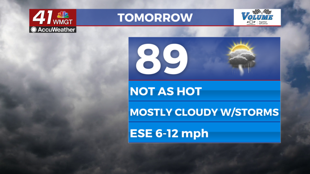
Tomorrow


Tuesday will be mostly cloudy with a few isolated storms possible again in the afternoon and evening. Highs will reach the upper 80s and lower 90s with ambient wind out of the east-southeast at 6-12 mph.


Overnight will also be mostly cloudy with lows expected in the low to mid 70s again. An isolated shower cannot be ruled out, but most of the region will stay dry. Ambient wind will be out of the east-southeast around 5 mph.
Wednesday and Beyond

Wednesday will be a bit warmer as more sun returns in the afternoon. Isolated storms are again possible in the afternoon and evening. July 4th will see slightly reduced rain odds, but they will climb again to end the week and through the weekend.


As for the Tropics, Hurricane Beryl is a top end Category 4 storm with 150 mph sustained winds. It will continue to track into the Caribbean and towards the Yucatan Peninsula in the coming days. Behind Beryl is Invest 96L, an area of disturbance being monitored for development in the next few days.

Follow Meteorologist Aaron Lowery on Facebook (Aaron Lowery 41NBC) and Twitter (@ALowWX) for weather updates throughout the day. Also, you can watch his forecasts Monday through Friday on 41NBC News at 4, 5, 5:30, 6, and 11 p.m.