

Very warm Thursday ahead of Friday storms
Temps today across Middle Georgia were once again in the mid to upper 70’s across the area, but a big warm up is on the way tomorrow.
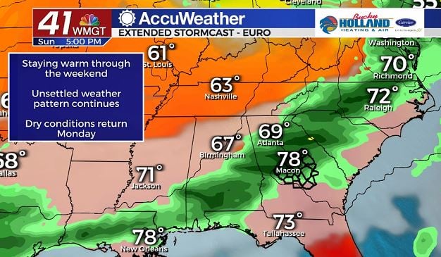
A warm front will be pushing in from the south and bringing highs in the mid 80’s along with increased moisture and windy conditions.
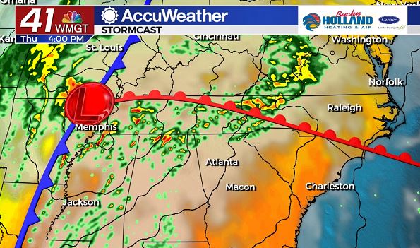
This setup will bring partly cloudy skies and wind gusts up to 25 mph to many of us in Middle Georgia, but the threat of a tornado outbreak to some areas that were already under the gun last week.
The cold front will push east through the day tomorrow, but low pressure that will aid in some uplift will be staying well to our north.
This should keep the axis of the worst weather to our north.
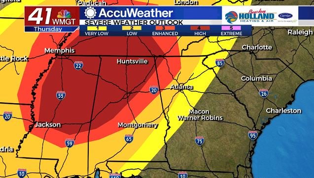
The greatest threat for strong, long track tornadoes, as pictured above, will be over Mississippi, Alabama, and Tennessee.
You will notice though, that there is still a level 3 threat for parts of Northeast Georgia, and if this storm system moves quickly (which it might) we could see a greater threat for strong storms as early as Thursday evening.
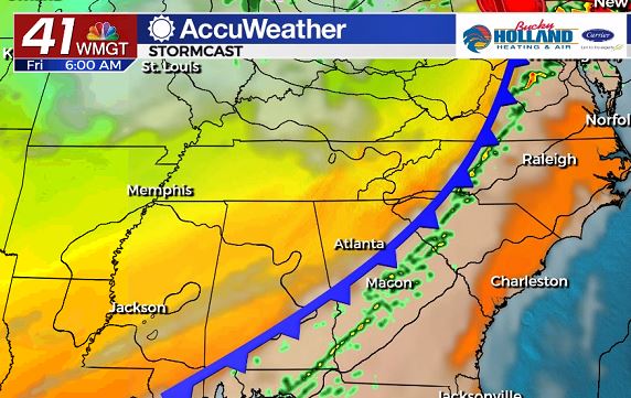
As the cold front moves through early Friday morning be ready for more gusty winds and a few strong storms.
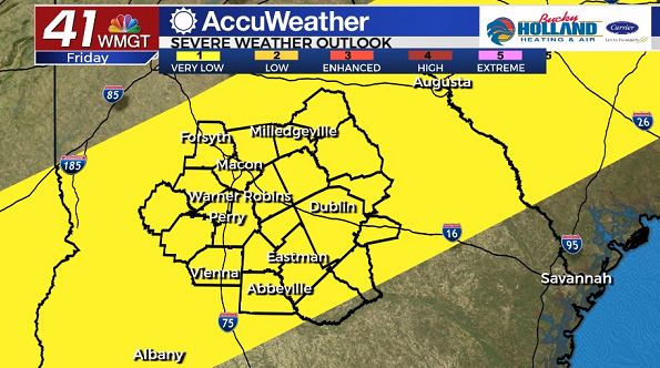
Right now the area is under a level 1 threat on Friday, with the main threat being damaging winds, and an isolated tornado, with heavy rain and large hail possible.
While Saturday will bring another chance for scattered showers and storms, it will be the best day of the weekend to get out and about.
Sunday, a cold front will be pushing back into the area bringing another chance of strong storms.
We don’t know quite yet about timing our impacts, but expect Sunday to bee a rainy day across Middle Georgia.
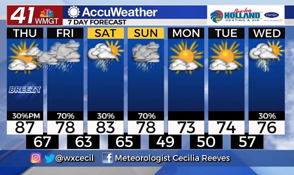
This front will be clearing out the rain to start next week, and also cool our highs down to the mid and low 70’s.
Leave a Reply