

Severe storm threat continues through Thursday
**SEVERE WEATHER IS POSSIBLE TOMORROW AFTERNOON AND THURSDAY MORNING. PLEASE HAVE MULTIPLE WAYS TO GET YOUR SEVERE WEATHER WARNINGS**
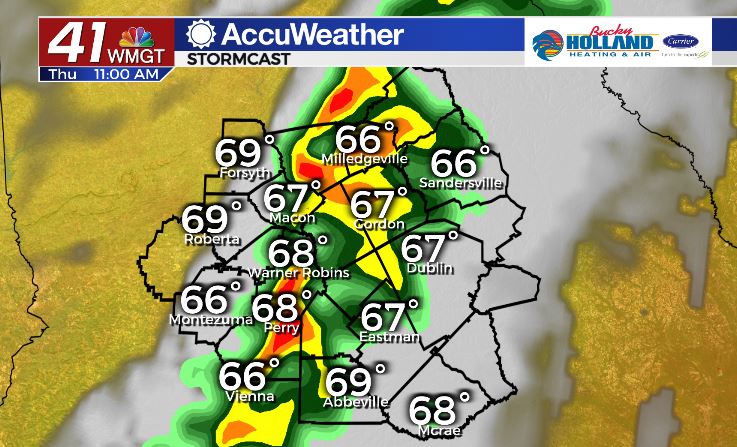
Rain began moving in across Middle Georgia this evening and so far, has brought much of the area north of Dublin some heavy rain.
We have been seeing a few thunderstorms as well, but as far as severe storms, most have just been a little grumbly and rainy.
Tomorrow we will see more of a typical severe set up with a level 2 of 5 (see above) threat.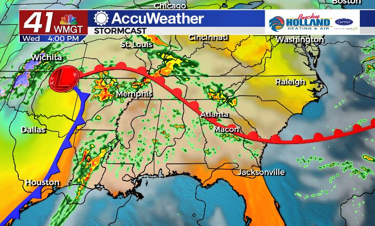
Pop up storms during the afternoon, will find an environment that is conducive for strong storms.
Main timing for these storms will be after 2pm-10pm, as we really start to warm up. 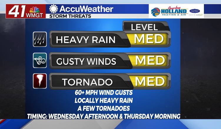
Threats for tomorrow afternoon will be more elevated than what we saw today.
Gusty winds will be the main threat with any storms that pop up, but we could also see a few tornadoes.
There is no reason to worry about it at this point, but preparing by having a way to get your severe storm warnings will be key.
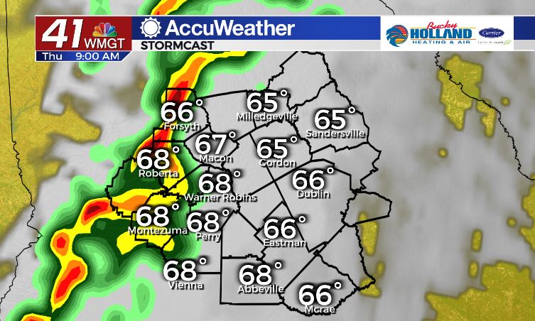
For much of the overnight hours on Wednesday we should actually get a break from the rain, but that will change early Thursday.
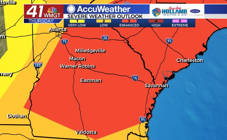
The Storm Prediction Center has us in a level 3 of 5 (above), so the threat is pretty serious.
Obviously things can change between now and Thursday (and they will), but right now timing for a squall line along the cold front will probably be during the morning hours.
These storms will be moving quickly, but could also contain rotating storms with 60 mph winds and tornadoes.
By around lunchtime most of the area could still be dealing with this line of storms and if we get some daytime heating we could see even more instability (that is bad btw).
Everything should be out of the area by Thursday afternoon, with clearing skies and highs in the mid to upper 70’s, before we get a big cool down for the weekend.
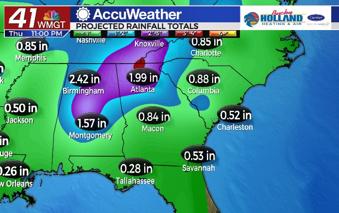
All in all expect an additional 1-3″ of rain between now and Thursday night, all depending on the type of storm development we see Wednesday.
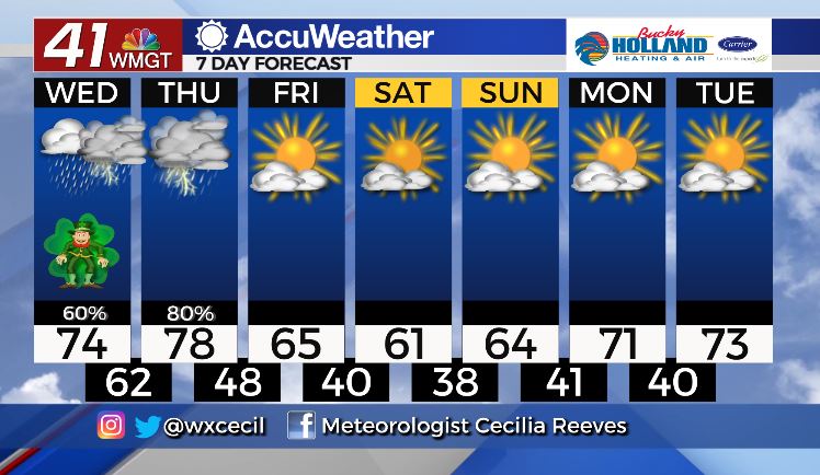
We finally get a break from the storms just in time for Cherry Blossom Festival this weekend!
Temps will be much cooler with highs in the 60’s, but hey, at least it won’t be raining.
Next week will start off dry as we warm back into the 70’s.
Leave a Reply