

Severe storms possible Tuesday
After a warm weekend and another warm Monday, we are watching our next weather system on the way to Middle Georgia.
This approaching cold front will bring increasing rain chances after midnight and into tomorrow afternoon.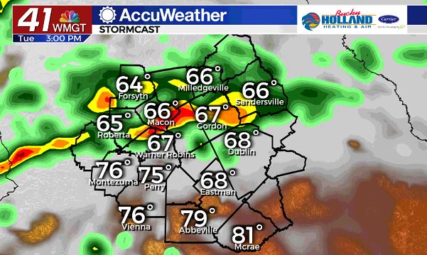
As a boundary moves south from the Metro Atlanta area, showers and storms will be firing up quickly.
Some of these storms could become strong to severe, with the main threats being damaging wind gusts, an isolated tornado, and heavy rain.
Main timing for these storms will be after 3pm, with storms ending by around midnight.
Rain and storms will not be completely done after this first round of storms.
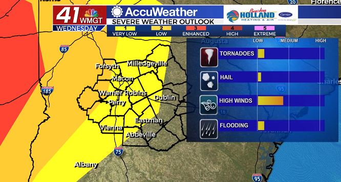
Although Wednesday will be mostly dry during the day (good for St. Patrick’s Day celebrations) storms will start popping up during the late afternoon.
Wednesday night into Thursday will bring another round of storms, this round will likely be stronger out to our west (Mississippi and Alabama), but here in Middle Georgia, the main threats will be damaging winds.
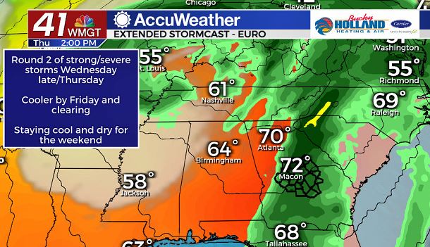
By Thursday afternoon the front will finally be moving through the area.
Severe storms will once again be possible Thursday afternoon, before we finally start to dry out and clear out.
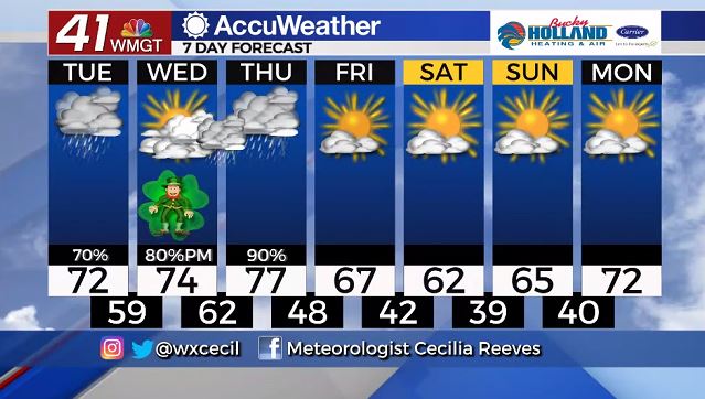
Clear skies start to return for much of the weekend, and so do some much cooler temps.
Weather should be great for celebrating the Cherry Blossom Festival, but you will probably need a jacket if you are going out during the evenings.
Leave a Reply