

Cold front brings increased chances for showers and storms
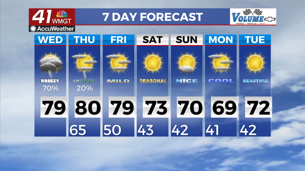
MACON, Georgia (41NBC/WMGT) – Low clouds and scattered light rain showers blanket much of North and Middle Georgia this morning. Soggy, dreary conditions will persist through the day 


as shower and thunderstorm coverage increases as a weak warm front lifts northward ahead of an approaching cold front. A tight pressure gradient between the approaching system to the west and the wedge that remains over the area will result in continued gusty winds particularly across North Georgia today. There remains a low-end risk for a couple of strong to severe thunderstorms capable of producing gusty winds and localized flooding. Currently , instability may be limited given the fact cloud cover is in place. If any breaks in the clouds occurs, instability may increase. Additionally, localized nuisance flooding mainly in low-lying or poor drainage areas will be a potential threat especially if showers or storms repeatedly move over the same areas or are slow 


moving. Overnight into early Thursday morning another batch of low clouds and fog can be expected. Over the course of the day, this next system will become more vertically stacked and slow down. Therefore, the cold front is likely not to make it through today, keeping at least a chance for rain in the forecast for many areas through Thursday. For today and Thursday temperatures will rise to the upper 60s to mid 70s and likely reaching 80 across parts of Middle Georgia where clouds are less prevalent. Overnight temperatures will remain mild tonight in the mid 60s and 50s at higher elevations. By Friday afternoon and evening the low pressure system continues to be situated over the Great Lakes region putting our area to the south. Another area of low pressure will round the base of the trough on Friday before being absorbed into the main flow which will result in another frontal boundary pushing into Georgia. Current models point towards limited rain chances (20% or less) with this system. Overall rain chances remain limited with the main impact into the weekend being cooler air being pushed into North Georgia behind this front. Temperatures decrease into the 30s overnight beginning as early as Saturday morning and lasting through at least Tuesday morning. High temps will also lower into the mid to upper 60s this weekend.