
Fall-like temperatures have arrived in Middle Georgia
MACON, Georgia (41NBC/WMGT) – The big story is cold air damming is finally here bringing the first real feel of Fall to parts of the region Wednesday, and that will expand into the coming days. 


Strong surface high is parked over the far northern Appalachians this afternoon and the wedge is already beginning to crash down to the south. Northeast winds are already getting into parts of the western North Carolina Piedmont and temperatures in some parts of the Virginia Piedmont have been decreasing. This will continue pushing south through the rest of the afternoon and should quickly push into Northeast Georgia sometime after midnight. Some uncertainty as to how far west and south the wedge makes it on Wednesday, but those inside the wedge will likely see cloud cover, some drizzle chances, and temperatures in the 70s for highs. Those outside will still have temperatures in the mid to upper 80s with some thunderstorm chances. Models tend to 


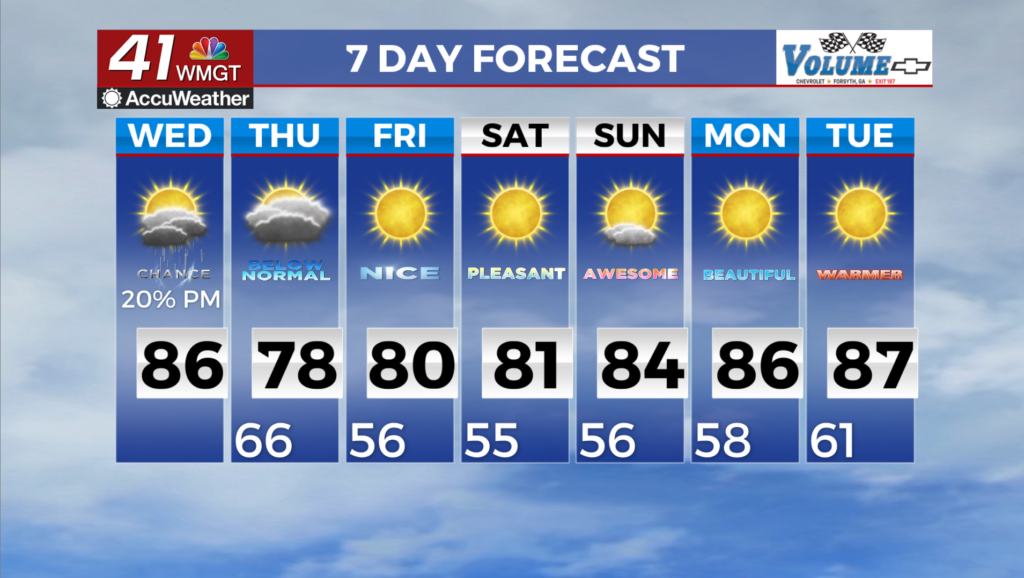
under do the actual westward extent, so I think a good size of the metro Atlanta will see much cooler conditions when compared to the previous few days. The wedge only grows stronger through the night on Wednesday, overspreading the entire region and bringing lows well down into the mid to lower 60s for most. We will get our first real taste of Fall to kick off the long term period Thursday across North and Middle Georgia. A strengthening low pressure system traveling northward just off the Mid-Atlantic coastline will help to reinforce a strong high pressure in place over the far Northeast U.S. and Southern Canada. There may be just enough moisture to support isolated rain showers at the higher elevations on Thursday however most places will remain dry. Drier air filtering into the region by way of north to northeasterly flow will result in more seasonal temperatures and near zero rain chances through the weekend. Forecast highs will be in the 70s to low 80s and lows in the 50s to 60s Thursday through Friday. A slight warm up is likely to occur over the weekend into early next week as daytime temperatures return to the mid to upper 80s.