Hot weather sticks around for start of the week
MACON, Georgia (41NBC/WMGT) – Mid-level ridging continues to slide into the region on Monday and a backdoor cold front will enter the area turning winds to the north-northeast at the 


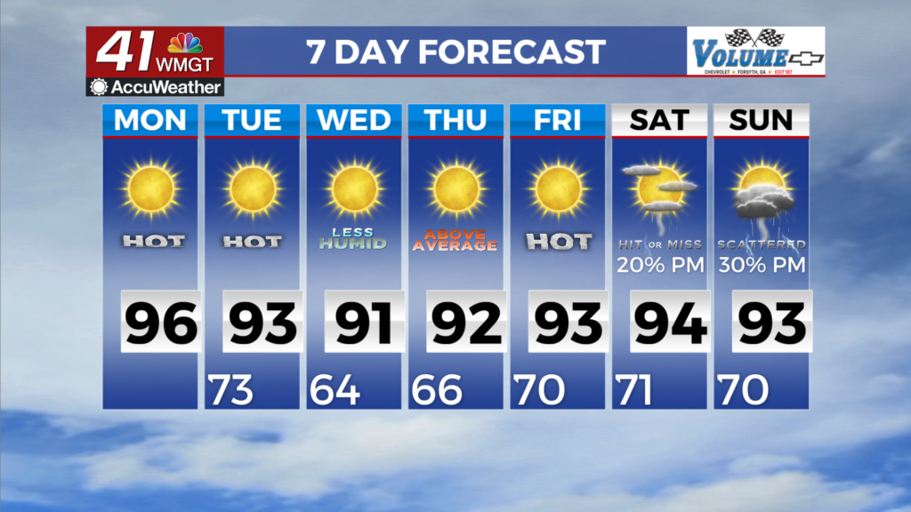
surface. A low chance for an isolated shower or storm at the higher elevations in association with the front but most will remain dry. The front will provide little if any relief from the heat as temperatures will once again rise back into the 90s and heat indices in the 90s to low 100s by the afternoon. The extended period begins Tuesday with an upper ridge centered over the Georgia/Tennessee/North Carolina borders along with a surface ridge/wedge nosing down the eastern seaboard from the New England states. By Tuesday morning the wedge will be firmly 


entrenched into North and Middle Georgia with East to Southeast winds in the 8 to 12 mph range. We will still have decent moisture across the area Tuesday as the drier airmass does not really start to move in until Wednesday. With the ridge/wedge building in we could still see a shower or two mainly across East Middle Georgia but not expecting much. As that drier air filters into the region Wednesday we will see dewpoints drop into the low to middle 60s and continuing across the state through the end of the week. High temperatures stay in the upper 80s to lower 90s through the end of the week but with the drier air moving in Heat Index values will drop from the upper 90s to lower 100s Tuesday to the lower 90s Wednesday to Friday. Models show moisture beginning to return Friday evening into Saturday as the ridge finally begins to break down. The continued east to southeasterly flow brings Atlantic moisture in across the state as we get into the weekend. Right now we are just looking at 20 to 30 percent chance of showers and thunderstorms Saturday and Sunday.