
Low humidity lasts for another day before temps rise
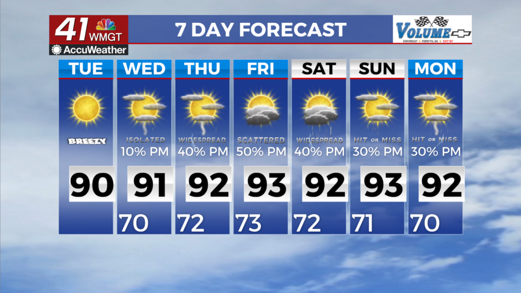
MACON, Georgia (41NBC/WMGT) – A mid-level ridge over South-Central U.S. will expand east over our area. Subsidence from the ridge (descending motion of air in the atmosphere occurs over 


a broad area) combined with even drier air moving in within the breezy easterly flow will result in very low rain chances. Temperatures in the morning will be around the upper 60s, and then climb to the mid to upper 80s to near 90 in the afternoon. Beginning midweek, what remains of a secondary lobe of mid-level high pressure will be gradually nudged offshore by the first in a series of shortwaves, accompanied by an advancing cold front. Most will remain dry on Wednesday (due to the continued impacts of wedging at the surface), with chances for isolated to scattered 


showers and thunderstorms relegated to the southern portion of the area. That area is in vicinity of the moisture extending across the northern Gulf. By Thursday, with further breakdown of our residual ridging, rain chances will return areawide, lingering well into the weekend. Greatest coverage is expected Friday through Sunday, as the front reaches Georgia from the northwest, filtering southward and stalling out across the midsection of the state. The weekend frontal passage appears to have minimal if any impacts on our temperatures, as highs are expected to be in the upper 80s to lower 90s each day. Morning lows will remain quite warm; in the upper 60s to lower 70s, as much as 6 to 12 degrees above average for this time of year.