
A seasonal start to the new week for Middle Georgia
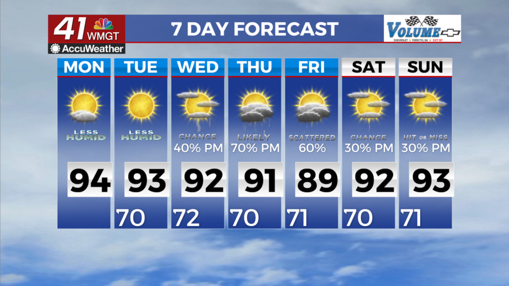
MACON, Georgia (41NBC/WMGT) – Calm weather is expected today through Tuesday. Dry conditions behind a cold front limits our thunderstorm chances to a minimal, contained to the 


southern parts of the coverage area. Winds will be out of the northwest at 5 to 10 mph. Drier weather is expected to expand further into the region tomorrow with relative humidity values in the afternoon dropping into the 35 percent range, making conditions feel lovely for this time of the year. Light and variable winds are expected overnight before picking up to 5 to 10 mph again under mostly clear skies. As the extended period begins, the axis of a longwave trough will be centered over the Atlantic coast, which will keep much of Georgia underneath northwesterly flow. 


Meanwhile, high pressure will be sliding across the Midwest. The combination of these factors will keep weather conditions dry and calm across the majority of the forecast area for one more day on Tuesday. Low temps will start the morning in the upper 60s and low 70s in Middle Georgia. Highs will climb into the low 90s in North Georgia and mid 90s in Middle Georgia on Tuesday afternoon. Isolated thunderstorms will be possible in portions of South-Middle Georgia during the peak heating hours, while dry air will keep chances minimal across the remainder of the area. Atmospheric moisture gradually moves over during the middle part of the week, and weak disturbances traversing the northwesterly flow will provide opportunities for thunderstorms on Wednesday afternoon and evening. On Thursday, another trough moving across the Great Lakes will advance a front towards far North Georgia. The front will gradually work its way southeast through the region on Thursday into Friday. Forcing ahead of the front and increased moisture will lead to scattered to numerous thunderstorms during the later part of the week.