
Cristobal becomes third named storm of Atlantic hurricane season
MACON, Georgia (41NBC/WMGT) – Cristobal becomes a tropical storm in the northern Atlantic Ocean while temperatures continue to climb in Middle Georgia.
This Evening
It’s been a hot afternoon across Middle Georgia and unlike yesterday there’s not a widespread round of storms to cool things off. A Heat Advisory is in effect for the majority of Middle Georgia until 8 pm this evening. A few storms are possible through the late afternoon and evening. The entire region is currently under a Level 1 “Marginal” threat for severe storms with the main hazard being a damaging wind gust or two.


Overnight will be partly cloudy with temperatures expected to drop into the low to mid 70s. The wind will be light out of the west. Some fog will be possible for those who see rain late this evening.
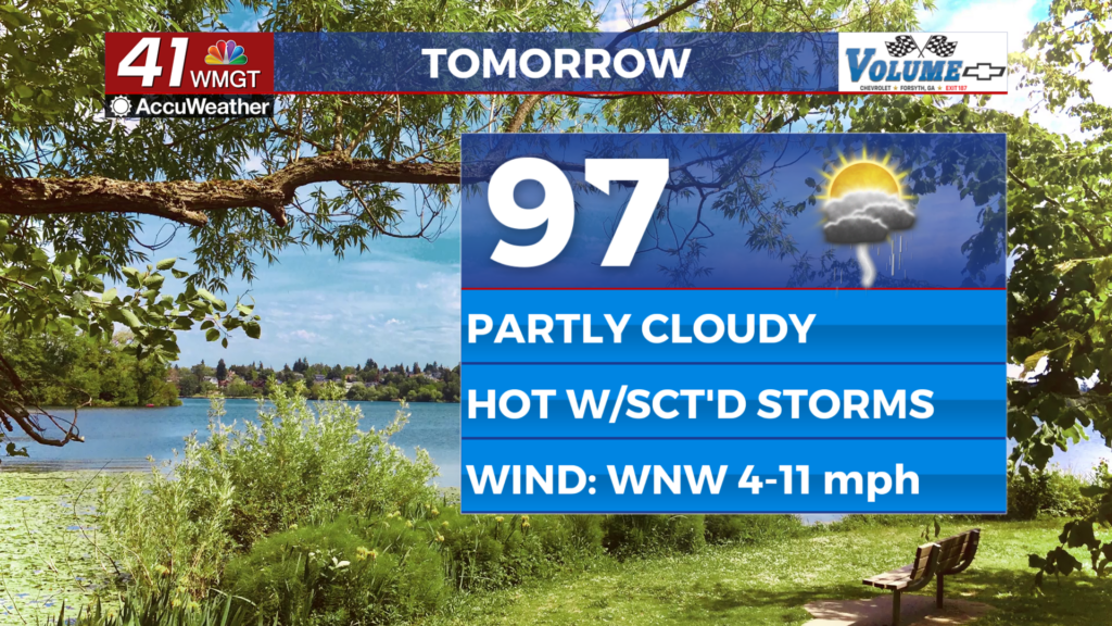
Tomorrow
Expect another Heat Advisory Thursday as temperatures are expected to largely reach the mid to upper 90s with heat indexes clearing 105 for a good chunk of the region. About half the region will see storms over the afternoon and evening hours. Wind will flow from the west-northwest at 5-12 mph.


Overnight will be partly cloudy and muggy with most low temperatures likely in the mid 70s. Fog will be possible again in the areas that receive rain in the evening. The wind will flow lightly out of the west.
Friday and Beyond
Storm odds are expected to be a bit higher Friday afternoon and evening as temperatures continue to reach into the upper 90s across the region. Those who will be attending any high school football games (or doing anything else outdoors) should bring the rain gear as well as sunscreen and plenty of water! The heat will continue to climb into the weekend as close to half the region sees storms each afternoon and evening.
Watching the Tropics
Tropical Storm Cristobal has formed in the northern Atlantic Ocean and is expected to travel east-northeast over the next few days. It poses no threat to North America. However there are two areas trying to develop in the southeastern Atlantic Basin off the west coast of Africa. The one leading the way pushing west has 80% odds to become a tropical depression within the next 48 hours. The other one has 40% odds to become a depression within the next 7 days. Both could potentially pose a landfall hazard either in the Caribbean, North America, or both down the road.

Follow Chief Meteorologist Aaron Lowery on Facebook (Aaron Lowery 41NBC) and X (@ALowWX) for weather updates throughout the day. Also, you can watch his forecasts Monday through Friday on 41NBC News at 4, 5, 5:30, 6, and 11 p.m.