
Scattered showers & storms impact parts of the weekend
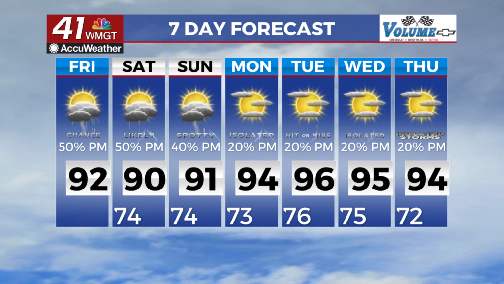
MACON, Georgia (41NBC/WMGT) – Scattered showers and thunderstorms have formed over northern Georgia as a front is slowly sinking southward. Coverage is expected to increase into the 


evening and overnight as we begin to transition the flow. As the trough to the north begins to shift slightly eastward, a surge of energy pushes through the flow into our area that will enhance the precipitation we will have ongoing along the frontal boundary over north Georgia. With this frontal boundary stalled out through Saturday, we are likely to see increased rain amounts with 1-3 inches possible with locally up to 4-5 inches. This will be highly dependent on where storms are able to train in one area for a long time period. The flood watch is currently in effect through Friday at midnight but this could be extended into Saturday if the heavy rain threat is expected to linger into the weekend. The expansion of the watch will be heavily dependent on what happens into the 


afternoon and evening and the later model ensembles. One positive of the increased rainfall is increased cloud cover. This will ultimately lead to decreased heat indices at least for North Georgia. Today they should top out in the upper 90s to near 100, but tomorrow will see heat indices in the low to mid 90s for North Georgia and up to 100 for the remainder of the area. Temps will be in the mid to upper 80s for far North Georgia and low to mid 90s for the remainder of the area. Saturday starts with the pattern in transition from a weak westerly flow to a full fledged north to northwest flow around a significant western ridge setting up. Models while fairly consistent at indicating a disturbance within the flow moving in our direction, they are very inconsistent in how convection evolves along and ahead of that disturbance. As a result, for Saturday expect a fairly high chance (60%) likely due to the uncertainty the northwest flow pattern brings. This yields a fairly low confidence percentage of precipitation forecast for Saturday ranging everywhere from mostly dry to decent storm coverage. The remainder of the extended period from Sunday to Wednesday locks the area into a solid north to northwest flow aloft, and a more uncertain pattern in terms of sensible weather.