

Another hot day before relief arrives
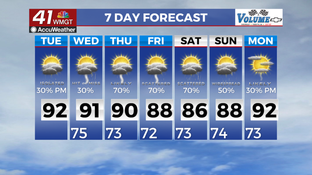
MACON, Georgia (41NBC/WMGT) – Today’s forecast will be more or less a carbon copy of Monday’s forecast. A shortwave trough begins swinging towards the Great Lakes region driving a surface 


front through the Ohio Valley towards North Georgia. An increase in southerly flow on the backside of the westward moving tropical system supports afternoon showers and thunderstorms across Middle Georgia, mainly south of I-20 this afternoon. Temperatures will also be a tad warmer today than yesterday with highs in the 90s with heat indices at or just below 105 in Middle Georgia. We can expect one final day of widespread heat index values exceeding 100 before temperatures ease to something a little more reasonable. A cold front (ha-ha) is expected late Wednesday 


afternoon and into the overnight hours of Thursday. A few areas in the southern portion of the viewing area may continue to see High Index Values as high as 100 through the week. Afternoon thunderstorm chances increase as a result, however as of right now there is only a marginal chance for severe weather as the best dynamics remain off to the northeast. The front filters in some drier air, and while temps will remain in the upper 80s and lower 90s it won’t be nearly as humid. Afternoon thunderstorm activity continues through the rest of the week. A few storms could be possible each afternoon. Gusty winds, frequent lightning and some localized flash flooding will be the main concerns to watch out for. We continue to monitor Tropical Storm Bertha in the Gulf and as of right now the current track is unlikely to impact Middle Georgia.