

Fewer storms mean hotter temps for Middle Georgia
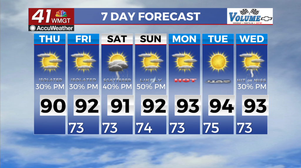
MACON, Georgia (41NBC/WMGT) – Expect a bit of a pattern shift to continue through the short term period as the area returns to a more typical summertime convective coverage. Showers and 


thunderstorms have popped up on radar with daytime heating and wind down after sunset. These should be the garden-variety storms, they are still capable of producing gusty winds, frequent lightning and locally heavy rainfall. High temperatures will top out in the mid to upper 80s to low 90s for today. The extended period begins in a transitional mid-level pattern with the mid-level upper ridge responsible for the Midwest/Northeast heat elongating and shifting off shore at the Southeast coast. As it does, the Northeast Gulf becomes situated between the developing western 


ridge and the elongated eastern ridge allowing for a TUT (Tropical Upper Level Trough) low feature to begin to develop over Florida and the northeast Gulf. As a result of the upper level transition into the weekend, the forecast confidence goes down with time through the remainder of the seven day period. Friday into Saturday looks like the hottest days with the highest Heat Index Values with many locations reaching 100 to 105 degrees! Friday also appears to have the highest possibilities for precipitation in the extended forecast, for at least now. Saturday will likely be similar to Friday with scattered to numerous coverage during the afternoon before the upper level low feature in the northeast Gulf starts to take shape, however this is also where models begin to differ a bit on the evolution of the low. One thing to mention with the development of the Northeast Gulf upper low is that the National Hurricane Center has now outlooked that area with a 20 percent probability of Tropical Development in the next 7 days.