
Typical Summertime pattern is in store for Middle Georgia
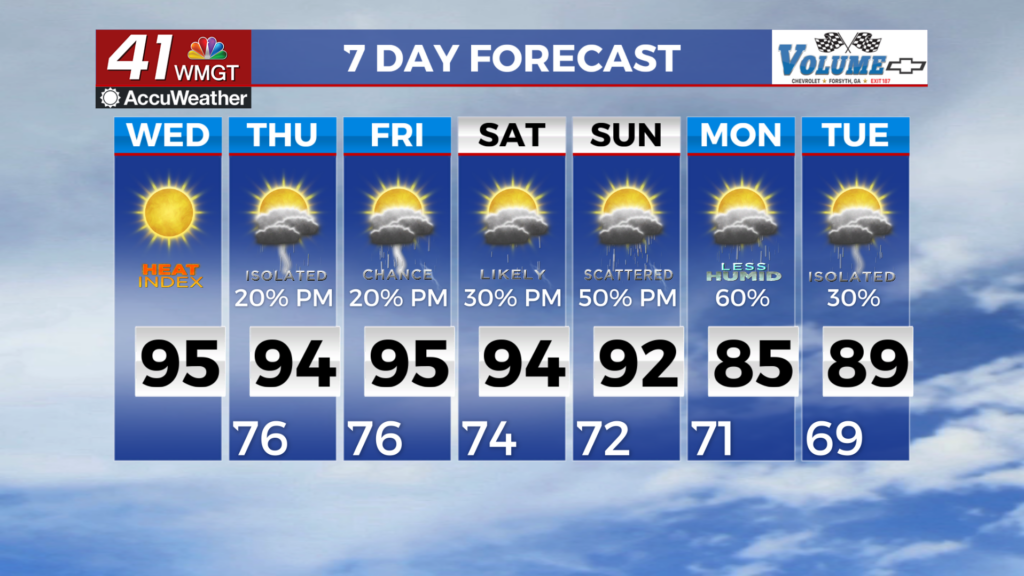
MACON, Georgia (41NBC/WMGT) – The typical Summertime pattern is in store for the next 48 hours with lower precipitation chances, despite there being a mid and upper level low situated over 


the Tennessee Valley and Georgia sitting in what should be a good location for higher coverage. The lower coverage can largely be attributed to the warmer values in the mid levels combined with lower than average dewpoints. Regardless, a few isolated showers and thunderstorms will be possible coinciding with maximum heating in the late afternoon and early evening today. Expect a slight southwest flow aloft across the area, and look for pockets of mid and upper level moisture rotating northeast around the ridge which could help locally enhance shower and thunderstorm 


coverage. Otherwise, the random isolated to scattered development is in store. On the temperature side, a Heat Advisory has been issued for portions of Middle Georgia for today. Maximum temperatures are slightly higher today. As a result, more counties have been included in the advisory that could reach 104 to 108 degrees. Peaking ahead to Thursday, a Heat Advisory could be issued for the similar location. Afternoon thunderstorms will continue to linger in the long term, and their chances will slowly increase through the second half of the work week as a stationary 


front slides down across the southeast. This should provide the region with a source of lift and as a result storms will increase in coverage from scattered chances to likely especially across the northern part of the state on Friday. The approaching front and afternoon convection should bring us some relief from the heat. Highs in the low to mid 90s with apparent temps in the triple digits will continue through Saturday before falling back into the 80s by the end of the weekend. The one saving grace here is that as storms become more numerous in the afternoon, radiational cooling will prevent a number of counties across the region from seeing peak heat during the afternoon and temps may not rise as high as they would without them.