
Last cool morning before it gets hot
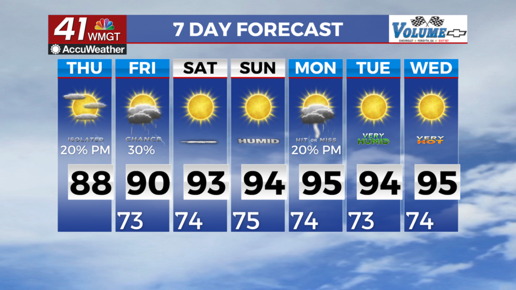
MACON, Georgia (41NBC/WMGT) – Temperatures will be slightly warmer than yesterday with highs across the region in the middle 80s to lower 90s range. Low temps tonight dipping down into 


the upper 60s to lower 70s. To begin the extended period, a ridge will be centered just west of the state over Mississippi and Louisiana. Given the strong ridge of high pressure, calm and dry conditions are expected through much of the period. With that being said, dangerously hot temperatures and heat index values are expected. Some low end precipitation possibilities are likely 


underneath this ridge however the main hazard will be the hot and humid conditions leading to dangerous heat index values this weekend and into early next week. Temperatures are expected to be above average as high pressure centers itself just west of the state. Maximum heat index values will likely get into the upper 90s to just over 100 degrees across much of the state by this weekend and into early next week. Be sure to limit your time outside, keep yourself hydrated, use sunscreen and be sure to check on the elderly.