Heavy rain may be a concern for the weekend
MACON, Georgia (41NBC/WMGT) – Overnight, a descending front brings our next widespread rainfall event. Upper level energy swooping down from the Central U.S. and the blocking pattern 


provides for synoptic lift. The best forcing will come from the subtropical shortwave that is undercutting the ridge. There are several significant caveats in the outcome of the collision between the two systems. First of all, how fast will the surface front descend into the area. Recent models have brought the surface front into the area faster than other models. This primes the area, setting up a boundary for rain to sit on. The second will be how strong the shortwave will be to drive some low level southwest flow as a moisture transport. Little variations in the moisture flux 


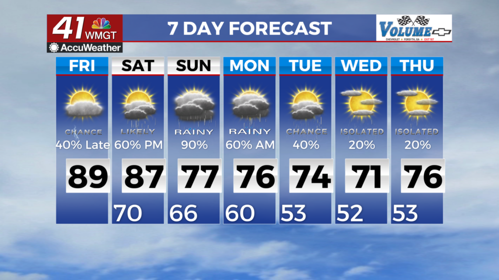
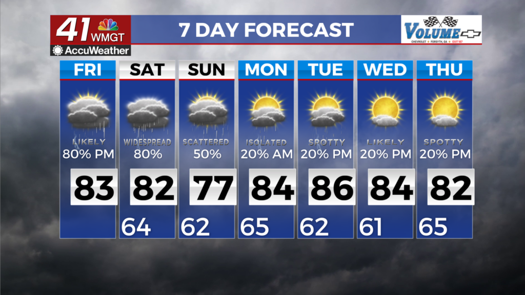
will play a significant role in the rain efficiency. Finally, how will the stalling front move or where will it settle, will determine where or if heavy rain could fall. Confidence is high that any rain received will be over 1.5 to 1.6 inches across Middle Georgia, although a sharp cutoff to the northeast of the front is expected. The main thing to watch for in the coming days will be the potential for training thunderstorms across Middle Georgia, or wherever the front stalls out. Models have begun to resolve isolated pockets of 4 inches or more of rain over 24 hours, which would be significant in most spots given the recent rainfall. Any heavy rain pocket will be isolated, and highly dependent on training of cells rather than strong storms like last week. The good news is that the best chances for the heaviest rainfall look to be south of the fall line, where significantly higher rates would be needed to induce flash flooding and drought is at its worst. Any rainfall will continue through Saturday as the front rebounds northward. Expect further rain coverage Saturday afternoon, though more storm motion will mean a lower flash flood threat. Temps Friday and Saturday will be cooler, as the front sags across the area. Highs around 80 will be likely across North Georgia, especially with heavier cloud coverage. Lows will be moderated by cloud coverage, holding in the mid to upper 60s tonight and tomorrow night.