


Dry and hotter conditions for Middle Georgia
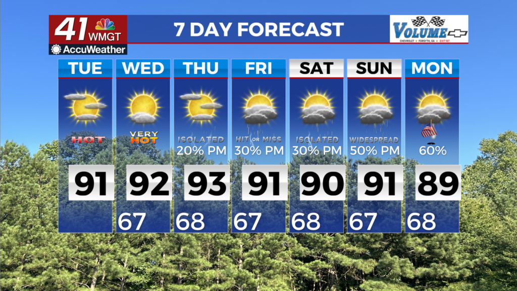
MACON, Georgia (41NBC/WMGT) – Conditions will be warm and rain-free for most areas today, courtesy of a dry airmass surging into the region throughout the day. The one portion of the 


area that could see an isolated afternoon shower or storm each day is across the Georgia/Alabama border, where moisture will be a little higher. Otherwise, mostly clear skies outside of high cirrus clouds and some afternoon fair weather cumulus clouds. High temperatures will climb into the upper 80s to low 90s across the region each day, with overnight lows only falling to the low to mid 60s. The long range forecast brings a summer-like pattern by our standards, characterized by warm and muggy conditions punctuated by daytime-enhanced scattered showers and 


thunderstorms. Rain chances begin to trend upward on Wednesday, primarily across north and northwest Georgia, as the Southeast ridge begins to flatten as a weak cold front makes slow progress southeastward. This front will not make much forward progress on Thursday as it becomes stationary across the Tennessee Valley amid southwest flow aloft. This will keep the highest chances for rain concentrated along and north of I-20 on Thursday. The front then begins to wash out and lift back northward by Friday as southwest flow aloft persists along the western side of the Atlantic ridge. While the ridge looks to gradually expand back westward a bit over the weekend, the deep moisture conveyor within the southwest flow should keep at least scattered convective coverage across north and west Georgia, although the bulk of the more consistent rainfall will remain relegated to the west. Any rainfall is appreciated and welcomed at this point, although this type of hit or miss summer-like convection will do little to alter the course of the ongoing drought. Temperatures will mainly remain a few degrees above normal, with highs ranging from the mid 80s to lower 90s and lows in the mid to upper 60s.