
Cool temperatures kick off the new week
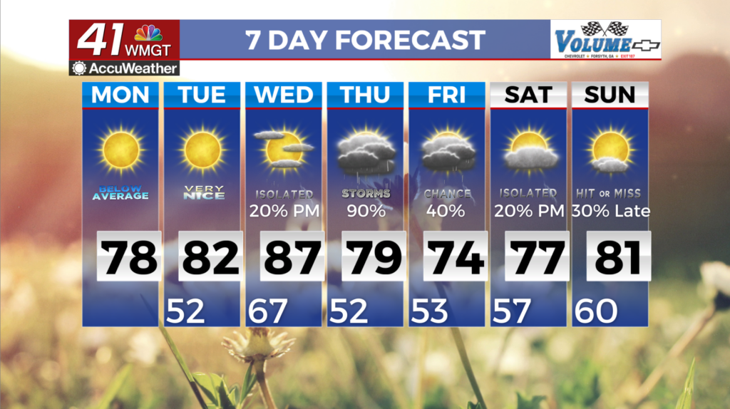
MACON, Georgia (41NBC/WMGT) – The continuation of cooler than normal temperatures starts off the first full week of May, before a gradual warming trend glides through the week. Clear 


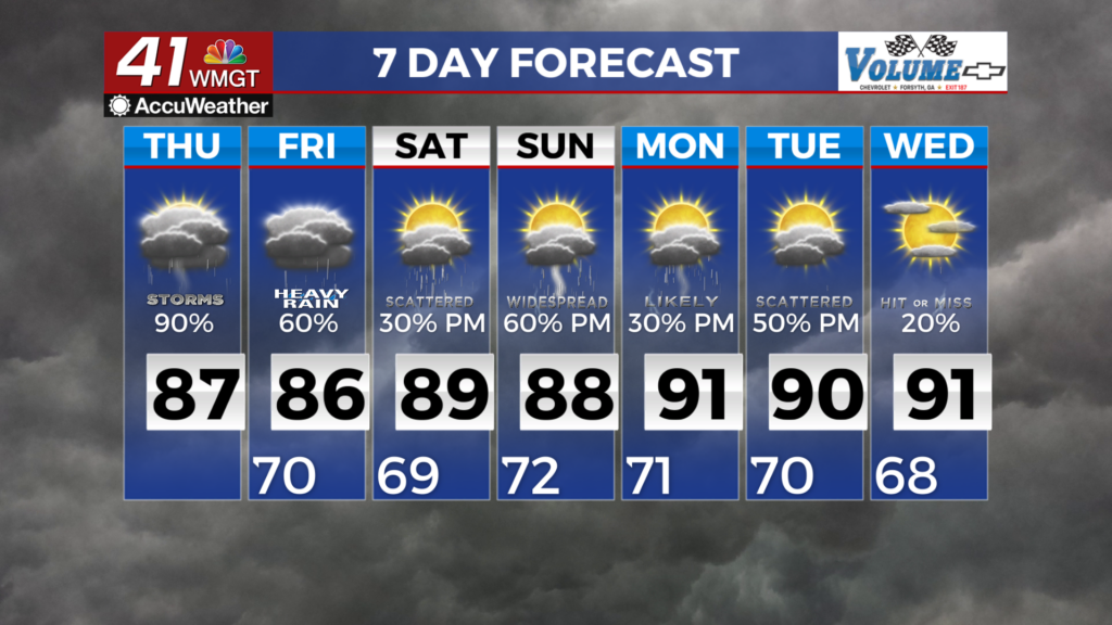
skies, dry air, and calm winds allows radioactive cooling to occur tonight, bringing temperatures into the low to mid 40s across the region. Be sure to bring a coat, but be ready to shed it as afternoon temps rise to the upper 70s and lower 80s. Uncertainty continues to dominate the forecast with respect to rain chances and intensity Wednesday and Thursday. The upper level flow pattern remains consistent with a subtropical ridge developing by Wednesday and a polar trough ejecting off the Rockies, splitting from a cut-off low. The uncertainty sits with the location of the ridge/trough and the timing of any surface shortwave from the cutoff low. It is that location of the interaction between the two airmasses in which we will see a good soaking rainfall. What is 


uncertain is the timing (sometime Wednesday afternoon through Thursday afternoon) and the intensity (thunderstorm potential). As for thunderstorm potential, this will be a factor of both timing (daytime heating) and the strength of the ridge (which will limit convection south of the ridge/trough interaction). At this time, the highest confidence in precipitation sits across the far northern counties of the region, and decreases quickly the further south you go. This pattern of intermittent precipitation chances is likely to continue until the full ejection of the cut-off low over the Southeast. Precipitation chances after midweek are below 40% due to uncertainty. Post frontal conditions this upcoming weekend will be cooler and mild with highs in the 70s to low 80s.