

Rounds of showers & thunderstorms start the new week
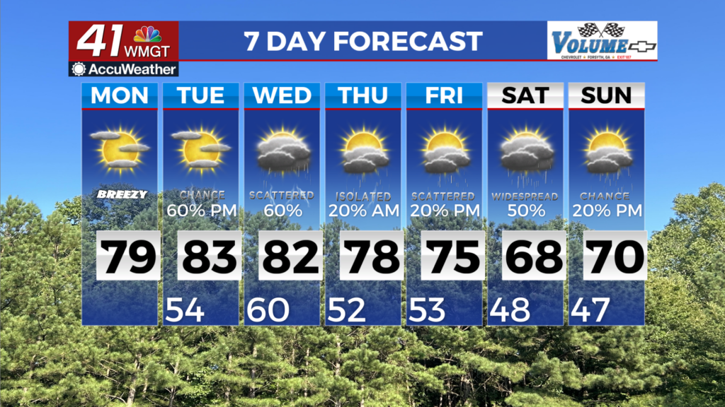
MACON, Georgia (41NBC/WMGT) – A weak frontal boundary continues to sag south across the extreme southern tier of counties today. An isolated stray shower or storm is not out of the 


question however chances remain low. Most places can expect pleasant temperatures and dry weather today given the post frontal environment. High temperatures this afternoon will climb into the low to mid 80s. High pressure has already begun and will slide into the region from the northeast today with a wedge setting up. A midlevel ridge briefly sets up from the southeast stretching up the East Coast. While temperatures are not expected to drastically fall, it will be notably cooler at least in parts of eastern Georgia and the higher elevations in the northeast both Monday morning and afternoon. Morning lows will range from the low 50s in eastern Georgia to low 60s in areas like Columbus. Monday afternoon temperatures will climb into the mid to upper 70s in eastern Georgia to low 80s elsewhere. The brief break in dry weather will be short-lived. Late Monday, a shortwave will quickly lift northeast across the Upper Midwest. At the surface, a low pressure system and surface front will quickly push across the Mississippi Valley towards the Tennessee Valley region. Moisture returns to the region Monday night into early Tuesday with increasing southerly flow ahead of the next weather system. Rain and thunder chances may begin as early as Monday night into early Tuesday for our northwestern counties. The extended period begins Tuesday morning with the next frontal boundary entering Northwest Georgia just before sunrise. This boundary will spread precipitation across the area Tuesday as it moves south through the region. As this front moves into the state instability weakens. We will see some thunderstorms with this system but the best location for any severe storm will be across Northwest Georgia where the best instability will be located. This first front is just the beginning as another wave is expected to move into the area Wednesday with another one Thursday. These two waves will bring more shower and thunderstorms to the area but again it does not look like we will see much in the way of severe weather.