

Staying warm, and dry for most through Saturday
MACON, Georgia (41NBC/WMGT) – Relative humidity values are forecast to be around 25-35 percent during Thursday afternoon and Friday afternoon. Winds will be southwest at around 


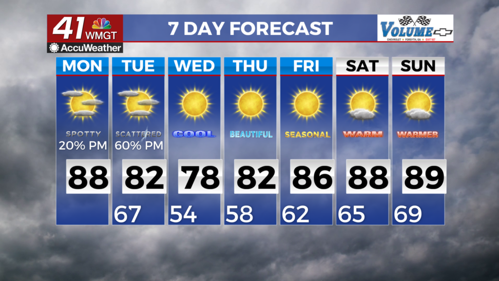
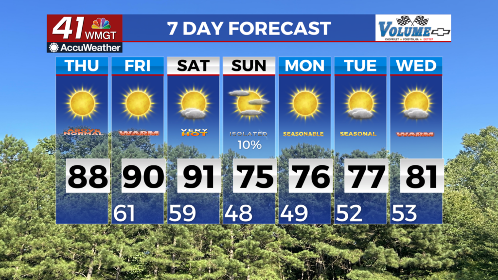
6-12 mph on Thursday and west at 4-8 mph on Friday. Gusts near 20 mph are possible this afternoon, with the risk of higher gusts for higher terrain. Although there is the potential for some rain showers Friday afternoon into the evening, mostly over North Georgia, measurable rain is unlikely. Due to ongoing drought and the lack of rainfall, critical fire weather conditions will be reached at the relative humidity value of 30 percent or less. The extended forecast begins right where the short term leaves off with dry and warm conditions continuing. With nearly zero precipitation chances Friday, and Saturday, temps are expected to rise well above seasonal levels with highs in the mid 80s to mid 90s across North and Central Georgia. The models are showing the ridge over the region weakening Saturday as a weak frontal boundary nears northwest Georgia Saturday night. The biggest issue is the atmosphere is extremely dry ahead of this front so as it pushes into the state it dries out and most of the area will only see increased cloud cover. Portions of Northwest Georgia will see some light showers Saturday night into Sunday morning. Unfortunately, even with this frontal boundary moving through it is not very likely to support the coverage and amount of rainfall necessary to put a dent in the drought that covers much of the region. The front is expected to move south and east of the area Sunday night bringing in a cooler and drier airmass for the beginning of next week. Temperatures Monday morning will be into the 40s with highs in the 70s. More importantly relative humidity values will be in the teens to lower 20s Monday and Tuesday keeping dangerous fire weather conditions across the area.
