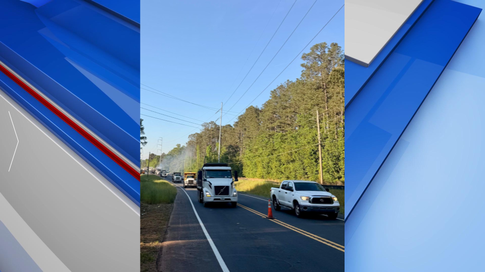

Fire weather concerns persist as temps rise
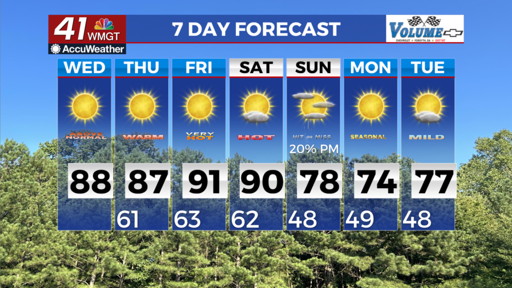
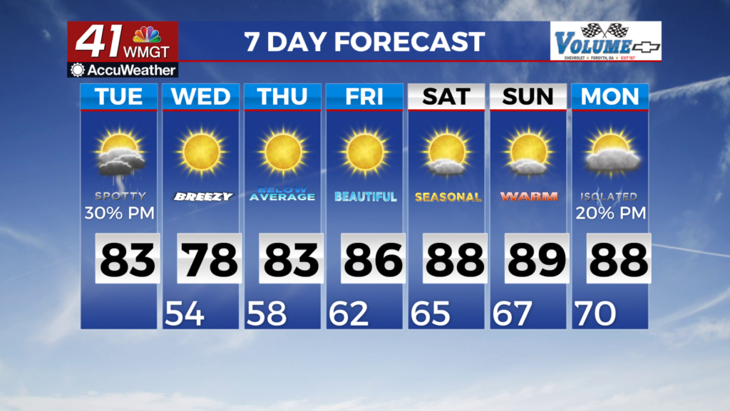
MACON, Georgia (41NBC/WMGT) – Expansive ridging remains in place keeping things high and dry. Temperatures will remain well above normal, as forecast highs are within a couple of 


degrees of daily record highs. Fire danger continues to be a concern. The extended period begins right where we left off with dry and warm conditions continuing. With zero precipitation chances Thursday, Friday, and Saturday, temps are expected to rise well above seasonal norms with highs in the middle 80s to middle 90s across North and Middle Georgia. The models are showing the ridge over the region weakening Saturday as a weak frontal boundary nears northwest Georgia Saturday night. The biggest issue is the atmosphere as it is extremely dry ahead of this front so as it pushes into the state it dries out and most of the area will only see increased cloud cover. Portions of northwest Georgia will see some light showers Saturday night into Sunday morning. Unfortunately, even with this frontal boundary moving through it’s very unlikely that this is going to support coverage and the amount of rainfall necessary to put a dent in the severe drought that covers much of the region. The front is expected to move south and east of the area Sunday night bringing in a cooler airmass for the beginning of next week. Temperatures Monday morning will be down into the 40s with highs Monday mainly in the 70s.