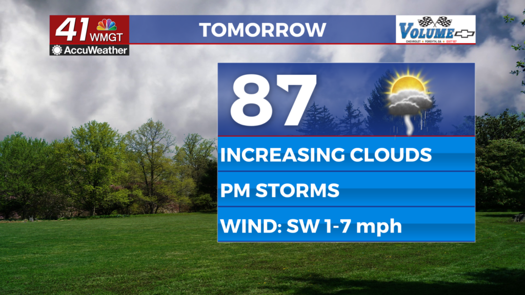
Dry weather continues beyond the weekend
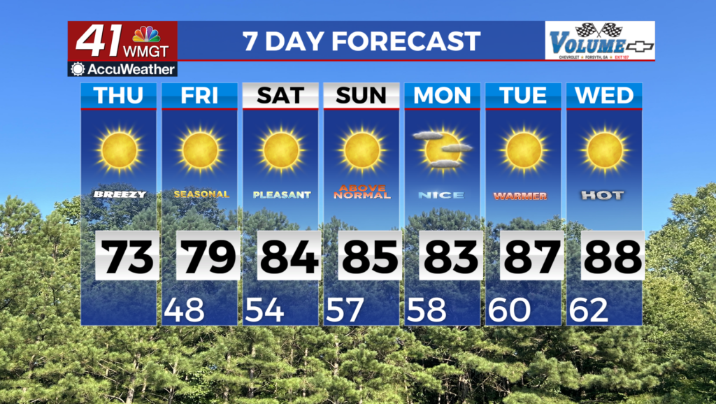
MACON, Georgia (41NBC/WMGT) – The current satellite loop shows mostly high clouds streaming across the area as high pressure continues to dominate the weather pattern. The ridge is 


currently centered over the New England states and is expected to stay fairly stationary through the short term. The ridge axis noses down the eastern seaboard and across into the Gulf coast states keeping us dry. There is also a wave/low pressure center just off the Carolina coast creating a strong pressure gradient (winds) across Georgia/South Carolina. This is why we saw east to northeasterly winds in the 10-15 mph range gusting to 25 mph yesterday. Winds have diminished some however, they will pick back up again this afternoon. These gusty winds combined with the very dry conditions and low relative humidity values will also keep fire weather concerns elevated across the region. Afternoon minimum relative humidity values will be in the 20 to 30 percent range through the rest of the week. Portions of North and Middle Georgia will likely stay under a Fire Danger Statement of a Fire Weather Watch through the end of the week. There is not much to talk about in the extended forecast. High pressure will continue over the area with not much relief in sight when it comes to rainfall. Temperatures will gradually warm from the upper 70s Friday to the mid 80s Sunday and the upper 80s by next Wednesday. Lows will follow a similar pattern starting out in the upper 40s Friday morning to the mid 60s by Wednesday morning. Temperatures will be 10 to 15 degrees above normal each day through the end of next week. Fire weather continues to be our main concern through next week with every day currently forecasted to reach fire danger statement conditions with relative humidity values in the 20 to 25 percent range most days. Burning is not advised.