More fire danger likely Thursday
MACON, Georgia (41NBC/WMGT) – Humidity will remain low along with elevated surface wind speeds Thursday afternoon allowing fire danger to persist.
This Evening
It’s been a mostly sunny and windy afternoon across Middle Georgia. The southeastern 2/3 of the region will remain under a Red Flag Warning until 8 PM tonight. Wind overnight will continue from the northeast t 6-13 mph with gusts still reaching as high as 20 mph. Overhead skies will be partly cloudy with temperatures expected to drop into the low to mid 40s across the region.
Tomorrow
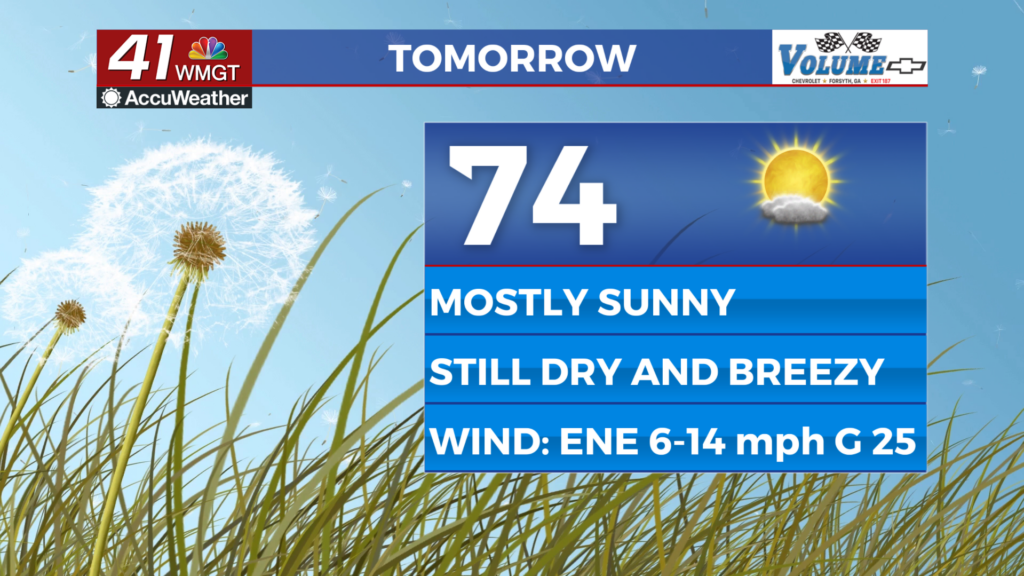
Thursday will be mostly sunny and should see similar overall conditions to Tuesday afternoon. Highs are likely in the low to mid 70s accompanied by winds from the east-northeast at 5-15 mph. Gusts will likely range anywhere from 15-25 mph and with no shift in that wind direction the humidity will remain low. Another Red Flag Warning will be possible for parts of the region tomorrow afternoon, or at least a Fire Danger Statement.


Overnight will be clear with temperatures likely to drop into the mid to upper 40s. The wind will be light from the northeast around 5-10 mph.
Friday and Beyond
A sunny end to the week is likely as high pressure moves over the Peach State. Wind will be light and variable leading into the weekend before shifting to out of the south by Saturday evening. This will allow temperatures to return to the 80s along with an increase in humidity. Still no rain is expected over the coming 7 day period.

Follow Chief Meteorologist Aaron Lowery on Facebook (Aaron Lowery 41NBC) and X (@ALowWX) for weather updates throughout the day. Also, you can watch his forecasts Monday through Friday on 41NBC News at 4, 5, 5:30, 6, and 11 p.m.