

Brief sprinkles possible for Tuesday
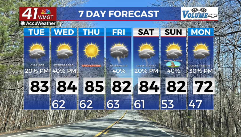
MACON, Georgia (41NBC/WMGT) – The influence of ridging will lead to continued warming across the region today. After low temperatures start the morning in the mid to upper 50s, highs will 


climb a few degree higher, rising into the low to mid 80s. These highs will range from 9 to 15 degrees above normal for the last day of March. With warmer temperatures and scattered clouds in the afternoon, there will be sufficient instability for diurnally driven convection, with isolated to widely scattered showers and thunderstorms anticipated in the afternoon. Severe weather is not anticipated at this time. Fire weather should not be a concern within this moist flow pattern. Patchy fog will be a possibility during the early morning hours each day, with nearly saturated conditions and light winds. Our models are still in good agreement showing the Bermuda ridge just off the Mid-Atlantic coast keeping North and Middle Georgia in a moist southerly flow through the weekend. This southerly flow will help warm temperatures through the end of the week with highs mainly in the 80s. This consistent southerly flow will also lead to increased diurnally-driven precipitation chances (showers and thunderstorms) from Wednesday through the weekend. Instability levels remain fairly weak under this Bermuda ridge so no widespread severe weather threat is anticipated at this time. We will see an isolated threat for strong storms as shortwaves move across the area from the Atlantic and the Gulf under the warm southerly flow.