

The temperature swings continues for Middle Georgia
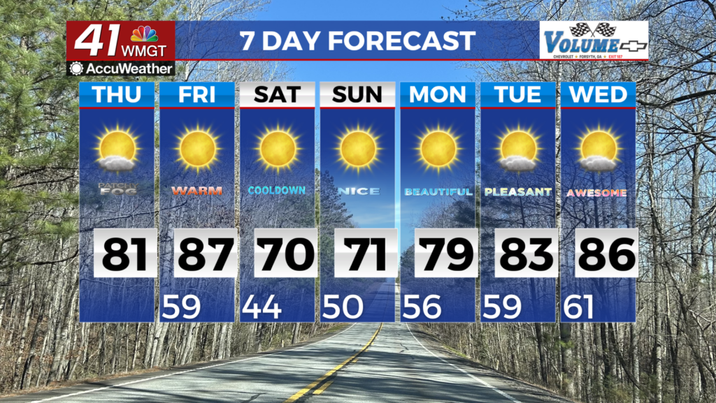
MACON, Georgia (41NBC/WMGT) – A quiet short term period is expected. Southeast winds will turn south later today, clearing out our skies and bringing with it a shot of warm moist air that 


will push temperatures back into the low 80s for most of the region. This trend is expected to continue into the long term forecast. There could be some morning fog along and south of I-16 this morning as temps and dewpoints start to ramp out, so keep this in mind as you plan your morning commute. Dry weather will persist through the extended period, although temperatures will definitely vary. Temperatures will initially soar well above normal on Friday, bringing highs well into the 80s areawide to near 90 in some spots. Daily record highs could be tied or broken. A cold front will bring the threat of record warmth to a halt over the weekend as it dips across the area late Friday. This front will be moisture-starved, bringing only the risk for a sprinkle or brief light shower to far north Georgia Friday afternoon. Otherwise, temperatures drop back close to normal over the weekend as high pressure returns in the wake of the front. The associated very dry post-frontal airmass will also bring fire weather concerns Saturday and Sunday. A big warming trend again takes hold next week as ridging builds overhead, bringing temperatures once again well above normal. There is no chance for any appreciable rainfall in sight through at least mid to late week next week, leading to worsening drought conditions.