
Warming trend begins for Middle Georgia
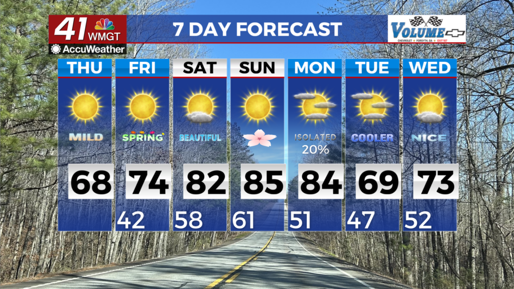
MACON, Georgia (41NBC/WMGT) – Another weak and dry clipper system will transverse the area today within the persistent northwest flow aloft. The airmass remains too dry for any precipitation. Temperatures begin to return to near seasonal levels Thursday with highs mainly in the 60s across the area. Lows tonight will be about 10 degrees warmer with lows in the 40s. 


It’s shaping up to be a rather tranquil 7-day period for our region. A large ridge and the heatwave over the southwest U.S. takes the headlines leaving the eastern portion of the country in a dry northwest flow. With no arctic air to surge in place temperatures should slowly rise into the weekend and peak in the 80s areawide by Sunday. One of the uncertainties with this northwest flow will be if any disturbances rotate around the ridge and slide southeast across the area. Some models at a few, one on Sunday and another on Monday which will only serve to add low end possibilities for precipitation to the forecast given the overall dry atmosphere. The next best chance of rain with a more significant disturbance and cool front comes in on Monday, albeit 20 to 30 percent at best. Temperatures cool a bit with the front on Monday and Tuesday behind the front but still seasonable.


