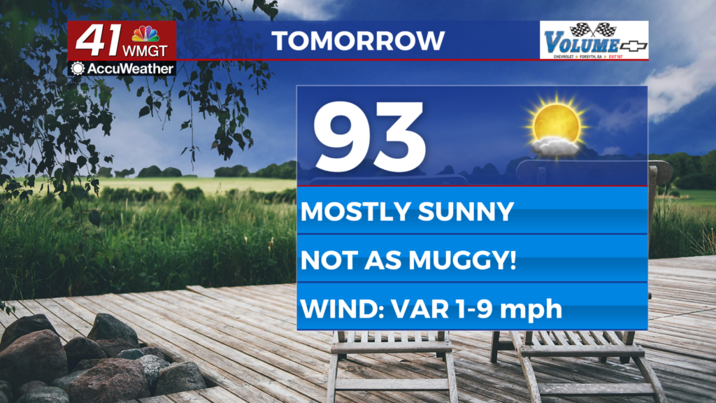
One more warm day before seasonal temps return to Middle Georgia
MACON, Georgia (41NBC/WMGT) – A stationary front remains stubbornly fixed across North Georgia as the remains of last night’s thunderstorms have weakened and moved out of the region. 


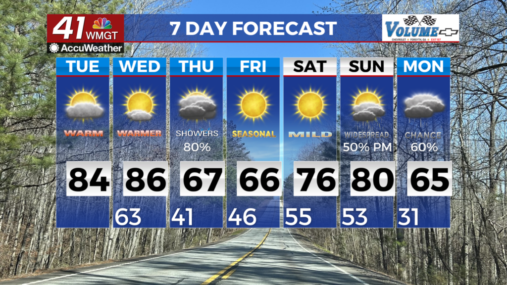
Severe weather is not expected with these storms however, a rogue shower could occur in the extreme northwest in the late afternoon. High temperatures are still expected to run above normal tomorrow with peak afternoon values in the upper 70s and lower 80s. Strong southwest flow continues to push warm moist air in from the Gulf. Overnight lows on Tuesday into Wednesday will run nearly 25 degrees above normal for much of the area. A majority of records could be threatened. That trend continues through the day as heat builds quickly. Daily records are likely to be tied or broken amid widespread highs in the 80s and even near 90 in parts of Middle Georgia. This warm, humid airmass come in advance of an incoming cold front that will bring the next impactful weather by Wednesday night. Right now the Storm Prediction Center has us in a Marginal Risk, with the best dynamics to the north and west of our coverage area. Thursday morning a cold front sweeps across our area through the day, bringing an end to the rainfall from the northwest to southeast. In the wake of the front, a brief return of cooler temperatures can be expected from Thursday into Friday. Even so, this cooldown really only gets us back to near normal for mid March, although a few areas of frost could be possible, mainly in the mountains Friday morning. Mid-level flow returns to a more zonal flow by Saturday and southwesterly by Sunday, kicking off a rapid warming trend with weekend temperatures again surging well above normal into the upper 70s and 80s.