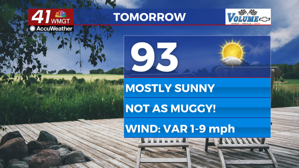
A foggy start leads to Spring-like temperatures for Wednesday
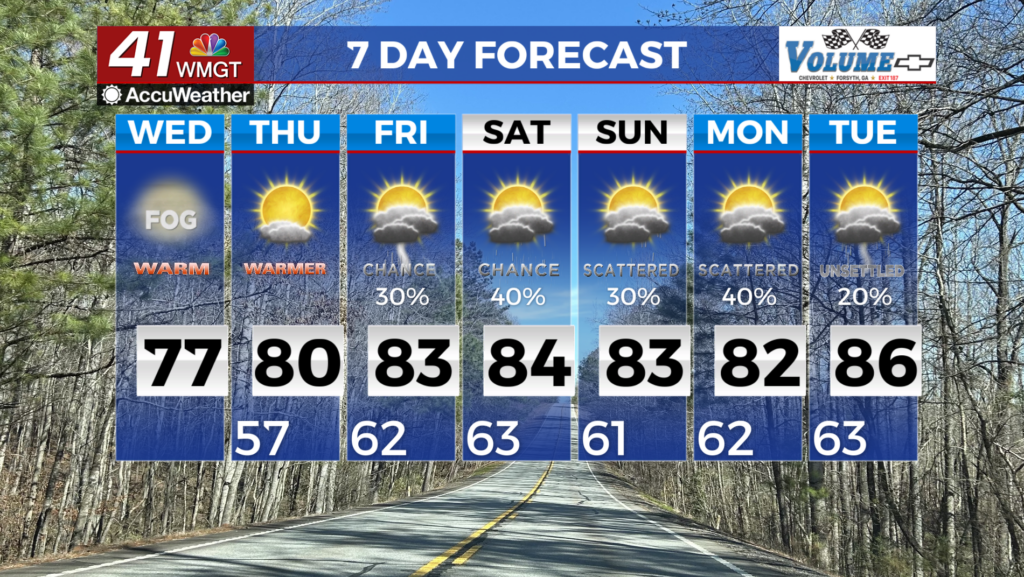
MACON, Georgia (41NBC/WMGT) – Early morning patchy fog starts off the morning commute, particularly over Eastern Georgia. Low clouds are likely to also make a return for your Wednesday. Clearing is likely later today, resulting in a sunny afternoon with daytime highs well above seasonal normal temperatures. Maximum temperatures for Thursday will be in the 


upper 70s to low 80s across Middle Georgia. We will get a nice taste of springtime later this week as temperatures are forecast to soar into the upper 70s to mid 80s. High pressure continues to hang off the east coast with the subtropical ridge taking up residence across the far southeast and eastern seaboard. As in previous posts rain chances for Thursday and Friday are pretty low (20-30%) due to a stronger ridge. By the weekend, unsettled weather is likely to make a return. The subtropical ridge loosens it’s hold over the area as shortwaves sweep across the High Plains and the Northern U.S. Ensemble models favor a potential for isolated to scattered thunderstorms each day however widespread severe weather remains unlikely at this time. It’s worth noting that rain chances have increased slightly compared to the previous forecast (now 30-40% each day), but the highest chances are still confined to much of North Georgia through the weekend. Temperatures through early next week are forecast to be in the 80s across most locations (perhaps 70s for higher elevations in the north).