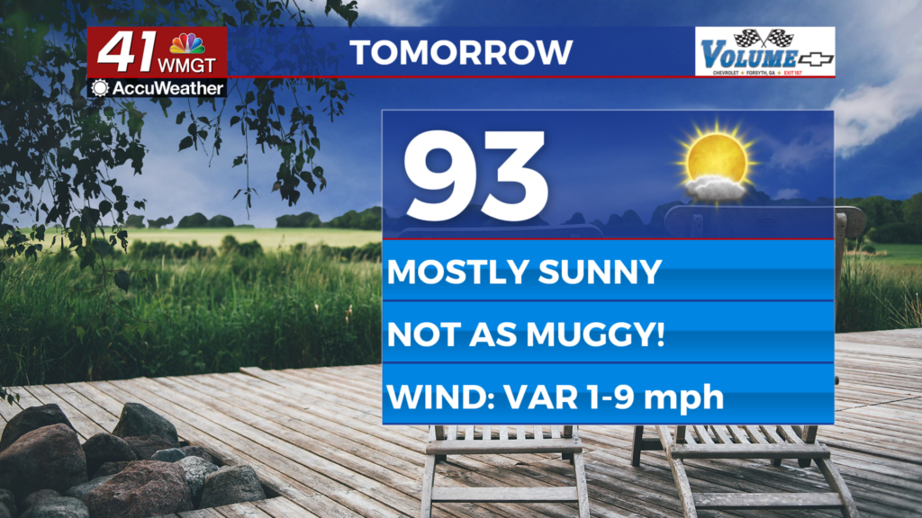
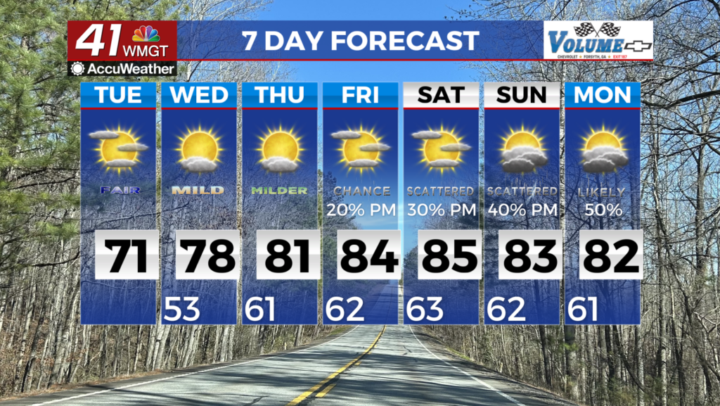
A brief cooldown then spring-like temperatures mid-week
MACON, Georgia (41NBC/WMGT) – Over the course of the day today, flow at the mid-levels continues to become zonal, with a strong high moving into place across New England. At it does, 


a wedge have begun to spread southward along the leeside of the Appalachians. That’s why we have cooler temperatures today. Low cloud cover will be slow to increase given the dry onset, with peak coverage from daybreak to early afternoon on Tuesday before gradual scattering of clouds begins from the southwest tomorrow afternoon into the evening. Weak cooler air continues to overspread the typical wedge areas (generally north and east of the I-75/I-20 interchange), with impacts strongest on Tuesday. Highs this afternoon will be in the 70s for all but a sliver of the areas under thickest cloud cover and the most prominent easterly flow (East Athens, and northeast Georgia). Models tend to struggle with wedge set ups, especially moist cool season set ups. Highs will likely remain in the 50s to near 60 within the wedge airmass, rising into the 60s to near 70 outside of it. The main story from mid-week through the weekend will be temperatures, as deep south-southwest flow brings an increasingly warm and humid airmass into Georgia. This flow will be driven by a highly amplified synoptic pattern, with a strong ridge building over the East Coast/Western Atlantic, and broad troughing over the western and Central U.S. Wednesday will be a transition day as the shallow wedge of cooler air is eroded by the rising of warm and humid air within the southerly flow. High temps will climb to the mid to upper 70s across the area, with low 80s in Middle Georgia. As the ridge strengthens on Thursday, stronger southwest flow brings an even warmer airmass up from the Gulf, with highs likely in the 80s across the area. These very warm temps remain in the area through the weekend, with a decent chance for some records to be broken depending on cloud cover and showers or storms.