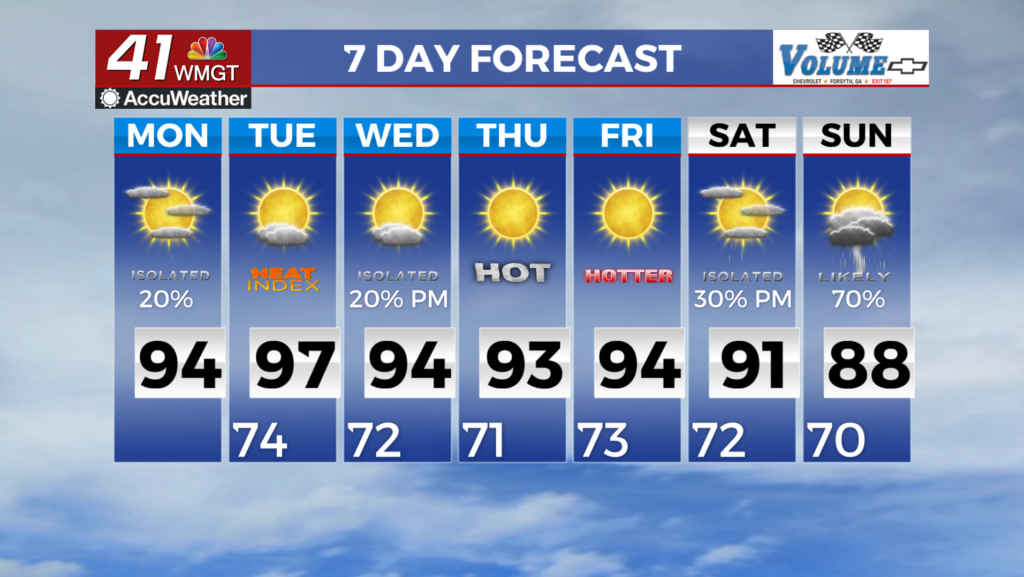
Bitter cold sticks around all week for Middle Georgia
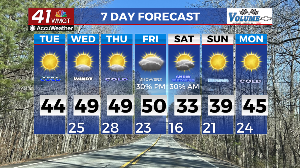
MACON, Georgia (41NBC/WMGT) – Today, and tomorrow can be described as dry, cold, and breezy. A Cold Weather Advisory is in effect for the entire region until 9 AM this morning, as 


wind chills (aka what it feels like on the skin) temperatures range from 0 – 15 degrees. In the mountains, wind chills as cold as 10 degrees below zero are expected. These wind chill temperatures are what it will feel like to people and animals. Actual air temperatures will bottom out in the single digits to teens across much of the area early this morning. This dry period is courtesy of a strong surface high pressure and upper level flow that favors sinking air in the atmosphere. Cold temperatures continue through the weekend and into the beginning of next week as troughing and a relatively cool airmass remain in place across the region. Low temperatures will remain in the teens and 20s each morning. High temps will mainly be in the 40s until next weekend when we see our next chance for some precipitation. A weak wave begins to develop along the Texas Gulf Coast Thursday night that moves east to the Florida Gulf Coast by Friday night. As it moves across the gulf it will begin to strengthen and develop into a closed low center by Saturday. This low center moves across Central Florida Saturday morning and up the eastern seaboard through Sunday night. With the cold airmass in place across the southeastern states, the backside moisture from this low center will bring light rain to the area Friday turning to snow on Friday night into Saturday morning then exiting the state by Saturday afternoon. The best locations for any possible accumulations will be across the eastern portions of the state that are closest to the low center. Right now we are just closely eyeing this system.